IMAGES TAKEN NEAR TO
Sorrel Way, SCUNTHORPE, DN15 8PL
Introduction
This page details the photographs taken nearby to Sorrel Way, DN15 8PL by members of the Geograph project.
The Geograph project started in 2005 with the aim of publishing, organising and preserving representative images for every square kilometre of Great Britain, Ireland and the Isle of Man.

There are currently over 7.5m images from over14,400 individuals and you can help contribute to the project by visiting https://www.geograph.org.uk
Image Map
Images are licensed for reuse under creativecommons.org/licenses/by-sa/2.0
Notes
- Clicking on the map will re-center to the selected point.
- The higher the marker number, the further away the image location is from the centre of the postcode.
Image Listing (9 Images Found)
Images are licensed for reuse under creativecommons.org/licenses/by-sa/2.0
Image
Details
Distance
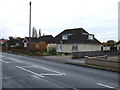
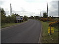
3
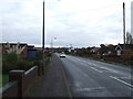
Roundabout on the Phoenix Parkway (A1077) Scunthorpe
Image: © Steve Fareham
Taken: 30 Jan 2014
0.12 miles
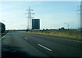
4
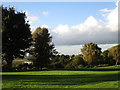
Autumn on Foxhills Sports Ground
Some of the wind turbines on the Flixborough Grange Windfarm can be seen in the distance.
Image: © Jonathan Thacker
Taken: 17 Oct 2016
0.17 miles
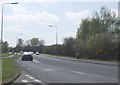
5
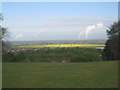
Power station emissions
From left to right - Ferrybridge, Eggborough, Drax. Seen from Foxhills Sports Field.
Image: © Jonathan Thacker
Taken: 16 May 2013
0.20 miles
6
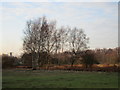
Silver birch in winter
Atkinson's Warren.
Image: © Jonathan Thacker
Taken: 20 Jan 2016
0.21 miles
8
Skippingdale
This is the entrance to the Skippingdale Estate.
Image: © fred roberts
Taken: 20 May 2005
0.21 miles