
IMAGES TAKEN NEAR TO
Farthing Avenue, SCUNTHORPE, DN15 8JU
Introduction
This page details the photographs taken nearby to Farthing Avenue, DN15 8JU by members of the Geograph project.
The Geograph project started in 2005 with the aim of publishing, organising and preserving representative images for every square kilometre of Great Britain, Ireland and the Isle of Man.

There are currently over 7.5m images from over14,400 individuals and you can help contribute to the project by visiting https://www.geograph.org.uk
Image Map
Images are licensed for reuse under creativecommons.org/licenses/by-sa/2.0
Notes
- Clicking on the map will re-center to the selected point.
- The higher the marker number, the further away the image location is from the centre of the postcode.
Image Listing (19 Images Found)
Images are licensed for reuse under creativecommons.org/licenses/by-sa/2.0
Image
Details
Distance
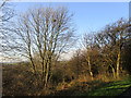
2
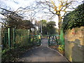
Entrance to the Hempdykes
Ridgeway Cycle Path.
Image: © Jonathan Thacker
Taken: 24 Dec 2014
0.10 miles
3
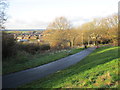
Ridgeway Cycle Path
Crossing the Hempdykes.
Image: © Jonathan Thacker
Taken: 24 Dec 2014
0.10 miles
4
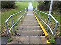
Flight of steps in urban green space
Presumably the yellow trough is to assist cyclists?
Image: © Graham Hogg
Taken: 23 Jan 2018
0.11 miles
5
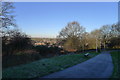
A frosty morning on the Scunthorpe Ridgeway
Looking west to the low ground beneath the Jurassic escarpment. The Scunthorpe ridge is an extension of the 'Lincoln Cliff' Image
Image: © Tim Heaton
Taken: 15 Jan 2016
0.13 miles
6
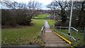
New path leading down to St Augutine Webster R C School
And also in direction of Berkeley Infant and Junior schools, although the
path doesn't show on maps as yet.
Image: © Chris Morgan
Taken: 23 Jan 2018
0.14 miles
7
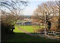
St. Augustine Webster Roman Catholic Academy
Seen from the Ridgeway Cycle Path.
Image: © Jonathan Thacker
Taken: 24 Dec 2014
0.16 miles
8
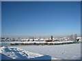
St. Augustine Webster RC Primary School
Closed because of the snow.
Image: © Jonathan Thacker
Taken: 3 Dec 2010
0.18 miles
9
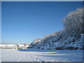
Snow on the Hempdykes
Looking towards Sherburn Crescent.
Image: © Jonathan Thacker
Taken: 3 Dec 2010
0.18 miles
10
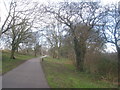
The Ridgeway Cycle Path
Passing through the Hempdykes. The Ridgeway Cycle Path links the western fringe of Scunthorpe with the industrial area to the north of the town.
Image: © Jonathan Thacker
Taken: 3 Mar 2014
0.19 miles