IMAGES TAKEN NEAR TO
Clapp Gate, SCUNTHORPE, DN15 0DB
Introduction
This page details the photographs taken nearby to Clapp Gate, DN15 0DB by members of the Geograph project.
The Geograph project started in 2005 with the aim of publishing, organising and preserving representative images for every square kilometre of Great Britain, Ireland and the Isle of Man.

There are currently over 7.5m images from over14,400 individuals and you can help contribute to the project by visiting https://www.geograph.org.uk
Image Map (Loading...)


Getting Data...Please wait
Leaflet Map data © OpenStreetMap
Images are licensed for reuse under creativecommons.org/licenses/by-sa/2.0
Notes
- Clicking on the map will re-center to the selected point.
- The higher the marker number, the further away the image location is from the centre of the postcode.
Image Listing (21 Images Found)
Images are licensed for reuse under creativecommons.org/licenses/by-sa/2.0
Image
Details
Distance
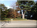
4
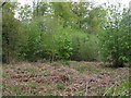
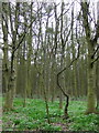
Lodge Farm
Photo taken from public footpath through Rowland Plantation.
Image: © David Wright
Taken: 14 Feb 2007
0.07 miles
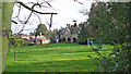
5
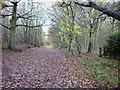
Public Footpath through Rowland Plantation
Photo taken about 100m NW of Lodge Farm.
Image: © David Wright
Taken: 14 Feb 2007
0.08 miles
6
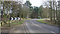
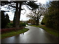
Near Lodge Farm
At this point the public footpath through Rowland Plantation (left) crosses the B1208 to enter Far Wood (right).
Image: © David Wright
Taken: 14 Feb 2007
0.08 miles
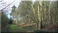
8
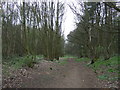
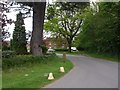
Path through woodland
Heading north near Lodge Farm.
Image: © JThomas
Taken: 5 Apr 2014
0.10 miles