IMAGES TAKEN NEAR TO
Rawcliffe Bridge, GOOLE, DN14 8SP
Introduction
This page details the photographs taken nearby to DN14 8SP by members of the Geograph project.
The Geograph project started in 2005 with the aim of publishing, organising and preserving representative images for every square kilometre of Great Britain, Ireland and the Isle of Man.

There are currently over 7.5m images from over14,400 individuals and you can help contribute to the project by visiting https://www.geograph.org.uk
Image Map
Images are licensed for reuse under creativecommons.org/licenses/by-sa/2.0
Notes
- Clicking on the map will re-center to the selected point.
- The higher the marker number, the further away the image location is from the centre of the postcode.
Image Listing (8 Images Found)
Images are licensed for reuse under creativecommons.org/licenses/by-sa/2.0
Image
Details
Distance
1
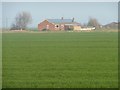
Commons Farm
Taking advantage of its aspect and isolation, with solar panels.
Image: © Christine Johnstone
Taken: 14 Mar 2012
0.01 miles
2
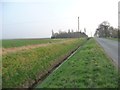
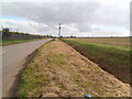
Drain alongside Johnny Moor Long Lane
All straight lines in this flat landscape.
Image: © Christine Johnstone
Taken: 14 Mar 2012
0.20 miles
3
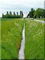
Drain beside lane
The lane is the Johnny Moor Long Lane which heads south to Thorne.
Image: © Jonathan Billinger
Taken: 27 May 2009
0.20 miles
4
Turn right
Johnny Moor Long Lane hits a bend.
Image: © Steve Fareham
Taken: 14 Jun 2008
0.21 miles
5
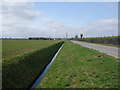
Flood Wall and Moor
The wall to the left is containing the Dutch River (River Don) and preventing the flooding of the low lying fields.
Image: © Michael Patterson
Taken: 7 Jun 2006
0.21 miles
6
Pilings alongside the River Don embankment
Image: © Glyn Drury
Taken: 17 Mar 2009
0.24 miles
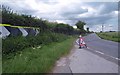
7
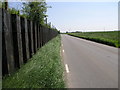
Thorne Road, Rawcliffe Bridge
The verge has been cut recently only to expose a shameful amount of litter as far as the eye can see.
Image: © David Brown
Taken: 17 Oct 2020
0.24 miles
8
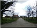
Entrance to Elms Farm
Pictured from Johnny Moor Long Lane.
Image: © Jonathan Clitheroe
Taken: 18 Apr 2016
0.25 miles