IMAGES TAKEN NEAR TO
Bridge Hill Close, GOOLE, DN14 8RY
Introduction
This page details the photographs taken nearby to Bridge Hill Close, DN14 8RY by members of the Geograph project.
The Geograph project started in 2005 with the aim of publishing, organising and preserving representative images for every square kilometre of Great Britain, Ireland and the Isle of Man.

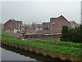
There are currently over 7.5m images from over14,400 individuals and you can help contribute to the project by visiting https://www.geograph.org.uk
Image Map
Images are licensed for reuse under creativecommons.org/licenses/by-sa/2.0
Notes
- Clicking on the map will re-center to the selected point.
- The higher the marker number, the further away the image location is from the centre of the postcode.
Image Listing (68 Images Found)
Images are licensed for reuse under creativecommons.org/licenses/by-sa/2.0
Image
Details
Distance
1
House-building, south side of Bridge Lane
Seen from the barge Sobriety, heading from Goole to Sprotbrough.
Image: © Christine Johnstone
Taken: 4 Apr 2014
0.01 miles
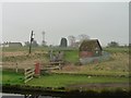
2
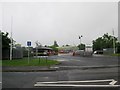
Entrance to Croda works Rawcliffe Bridge
At the junction of Bridge Lane and Paper Mill Road
Image: © Martin Dawes
Taken: 15 Jun 2016
0.03 miles
3
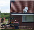
What a turkey
Ignore the reflection of the geographer!
Image: © Steve Fareham
Taken: 14 Jun 2008
0.03 miles
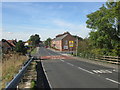
4
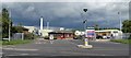
Entrance to Croda Chemicals site, Rawcliffe Bridge
Where Mr Crowe and Mr Dawe began, but very much up to date; https://www.croda.com/en-gb/careers/our-locations/europe-and-eemea/united-kingdom
Image: © Chris Morgan
Taken: 6 Jul 2020
0.03 miles
5
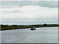
Narrowboat on the Aire & Calder, Rawcliffe Bridge
Heading east towards the bridge and Goole.
Image: © Christine Johnstone
Taken: 19 Jun 2015
0.04 miles
6
Beneath Rawcliffe Bridge
Looking west along the Aire and Calder Navigational (Knottingley and Goole Canal).
Image: © Neil Theasby
Taken: 22 Dec 2019
0.05 miles
7
Stile, Aire & Calder south bank, Rawcliffe Bridge
Alongside a drain between the canal and the Dutch River. Seen from the barge Sobriety, heading from Goole to Sprotbrough.
Image: © Christine Johnstone
Taken: 4 Apr 2014
0.05 miles
9
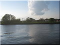
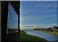
View across the canal at Rawcliffe Bridge
Drax power station always seems to have its own weather system. The power lines that are marked on OS maps now pass under the Aire and Calder Canal and the Dutch River.
Image: © Jonathan Thacker
Taken: 6 May 2012
0.06 miles
10
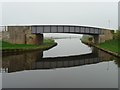
Rawcliffe Bridge
Carrying Bridge Lane over the Aire & Calder Navigation. Seen from the barge Sobriety, heading from Goole to Sprotbrough.
Image: © Christine Johnstone
Taken: 4 Apr 2014
0.06 miles