
IMAGES TAKEN NEAR TO
Cleveland Close, GOOLE, DN14 5FG
Introduction
This page details the photographs taken nearby to Cleveland Close, DN14 5FG by members of the Geograph project.
The Geograph project started in 2005 with the aim of publishing, organising and preserving representative images for every square kilometre of Great Britain, Ireland and the Isle of Man.

There are currently over 7.5m images from over14,400 individuals and you can help contribute to the project by visiting https://www.geograph.org.uk
Image Map
Images are licensed for reuse under creativecommons.org/licenses/by-sa/2.0
Notes
- Clicking on the map will re-center to the selected point.
- The higher the marker number, the further away the image location is from the centre of the postcode.
Image Listing (46 Images Found)
Images are licensed for reuse under creativecommons.org/licenses/by-sa/2.0
Image
Details
Distance
1
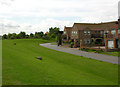
New houses at Ferry Lane, Hook
New houses built in stages since around 2000, protected by the high floodbank at the very northern end of the village of Hook.
Image: © George Robinson
Taken: 10 Jul 2008
0.03 miles
2
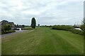
River bank beside Jetty Close
Looking along the banks of the River Ouse in Hook.
Image: © DS Pugh
Taken: 17 Jun 2023
0.05 miles
3
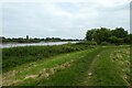
Path near Ferry Lane
Looking along a path on the banks of the River Ouse near Ferry Lane in Hook.
Image: © DS Pugh
Taken: 17 Jun 2023
0.05 miles
4
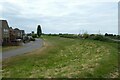
Embankment near Ferry Lane
A ferry used to connect Hook to Howdendyke across the River Ouse.
Image: © DS Pugh
Taken: 17 Jun 2023
0.05 miles
5
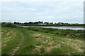
Location of the former ferry
Looking across the River Ouse from Hook to Howedendyke.
Image: © DS Pugh
Taken: 17 Jun 2023
0.05 miles
6
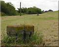
Disused mooring bollards
A row of stone bollards lies between the floodbank and the River Ouse, I believe they mark the site of a former jetty.
Image: © George Robinson
Taken: 10 Jul 2008
0.06 miles
7
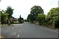
High Street near Ferry Lane
Looking along High Street in Hook.
Image: © DS Pugh
Taken: 17 Jun 2023
0.06 miles
9
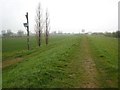
Ouse floodbank
Looking north-west from the end of Ferry Lane, Hook (the ferry has long since gone). Part of the Howdendyke port installations on the other side of the river can be seen distantly through the mist.
Image: © Oliver Dixon
Taken: 23 Apr 2008
0.07 miles
10
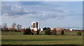
Fields beyond end of High Street, Hook
Hook lies to the north of Goole on the inside bend of a meander of the River Ouse. The river loops out of sight, around the fields with the factory units being on its far side.
Image: © Trevor Littlewood
Taken: 25 Dec 2011
0.07 miles