IMAGES TAKEN NEAR TO
Whitley Thorpe Lane, GOOLE, DN14 0JH
Introduction
This page details the photographs taken nearby to Whitley Thorpe Lane, DN14 0JH by members of the Geograph project.
The Geograph project started in 2005 with the aim of publishing, organising and preserving representative images for every square kilometre of Great Britain, Ireland and the Isle of Man.

There are currently over 7.5m images from over14,400 individuals and you can help contribute to the project by visiting https://www.geograph.org.uk
Image Map
Images are licensed for reuse under creativecommons.org/licenses/by-sa/2.0
Notes
- Clicking on the map will re-center to the selected point.
- The higher the marker number, the further away the image location is from the centre of the postcode.
Image Listing (14 Images Found)
Images are licensed for reuse under creativecommons.org/licenses/by-sa/2.0
Image
Details
Distance
1
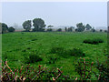
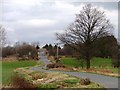
Whitley Thorpe - The Moat ??? What Moat ???
Dead centre of this O/S grid square is shown a moat. This is a photograph of the place the moat is indicated. Whatever signs there are that it does exist are not apparent to me.
Image: © Bill Henderson
Taken: 24 Sep 2006
0.11 miles
2
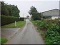
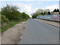
Entering Whitley Thorpe, on Whitley Thorpe Lane, from the west
Image: © Bill Henderson
Taken: 24 Sep 2006
0.12 miles
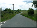
5
Gravehill Lane near to Whitley Common Nature Reserve
Looking north-eastward. The Nature Reserve is over the hedge on the left of the picture. On the right is the Regal Bennett Factory
Image: © Peter Wood
Taken: 13 Apr 2019
0.15 miles
6
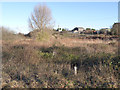
Whitley Common
A rather scruffy area of common land near Whitley Thorpe.
Image: © Alan Murray-Rust
Taken: 24 Dec 2013
0.16 miles
7
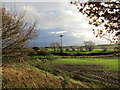
View across Booty Lane
On a squally day. An open flat landscape with several areas of woodland.
Image: © Jonathan Thacker
Taken: 20 Nov 2015
0.16 miles
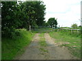
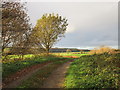
9
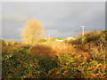
Booty Lane, looking north-east
Climbing up to and beyond the 9 metre spot height.
Image: © Christine Johnstone
Taken: 19 Feb 2014
0.16 miles
10
Track and Gale Common Ash Disposal Site
The land immediately to the right of the picture is a small piece of common land and a nature reserve.
Image: © Jonathan Thacker
Taken: 20 Nov 2015
0.17 miles