IMAGES TAKEN NEAR TO
Ferry Boat Lane, DONCASTER, DN12 4LB
Introduction
This page details the photographs taken nearby to Ferry Boat Lane, DN12 4LB by members of the Geograph project.
The Geograph project started in 2005 with the aim of publishing, organising and preserving representative images for every square kilometre of Great Britain, Ireland and the Isle of Man.

There are currently over 7.5m images from over14,400 individuals and you can help contribute to the project by visiting https://www.geograph.org.uk
Image Map (Loading...)


Getting Data...Please wait
Leaflet Map data © OpenStreetMap
Images are licensed for reuse under creativecommons.org/licenses/by-sa/2.0
Notes
- Clicking on the map will re-center to the selected point.
- The higher the marker number, the further away the image location is from the centre of the postcode.
Image Listing (33 Images Found)
Images are licensed for reuse under creativecommons.org/licenses/by-sa/2.0
Image
Details
Distance
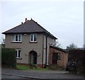
3
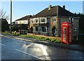
Telephone kiosk in Old Denaby
At Denaby Lane's junction with Ferryboat Lane.
Image: © Neil Theasby
Taken: 22 Jan 2016
0.07 miles
4
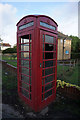
Disused telephone kiosk on Denaby Road, Old Denaby
Image: © Ian S
Taken: 19 Sep 2018
0.07 miles
5
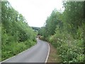
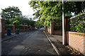
Ferry Boat Lane near Old Denaby
Looking in the direction of the village on a mainly overcast Saturday afternoon in mid June. Ferryboat Farm Fishery is located out of shot to the right of this picture.
Image: © Jonathan Clitheroe
Taken: 18 Jun 2011
0.09 miles
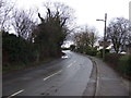
9
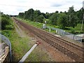
Mexborough Ferry Boat railway station (site), Yorkshire
Opened in 1850 by the South Yorkshire Railway, later part of the Manchester Sheffield & Lincolnshire Railway on the line from Doncaster to Barnsley, this station probably closed in 1872 when it was replaced by the current Mexborough station.
View west towards Mexborough and (formerly) Barnsley. The 1854 OS map simply labelled it as "Mexborough station" but only accessibly by ferry and footpath. Other sources labelled it as "Ferry Boat Halt". No trace apparently remains.
Image: © Nigel Thompson
Taken: 11 Jul 2020
0.18 miles
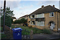
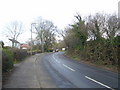
10
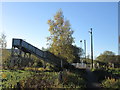
Footbridge and Ferry Boat Lane crossing
Image: © John Slater
Taken: 4 Nov 2013
0.18 miles