IMAGES TAKEN NEAR TO
Park Road, DONCASTER, DN12 2ES
Introduction
This page details the photographs taken nearby to Park Road, DN12 2ES by members of the Geograph project.
The Geograph project started in 2005 with the aim of publishing, organising and preserving representative images for every square kilometre of Great Britain, Ireland and the Isle of Man.

There are currently over 7.5m images from over14,400 individuals and you can help contribute to the project by visiting https://www.geograph.org.uk
Image Map (Loading...)


Getting Data...Please wait
Leaflet Map data © OpenStreetMap
Images are licensed for reuse under creativecommons.org/licenses/by-sa/2.0
Notes
- Clicking on the map will re-center to the selected point.
- The higher the marker number, the further away the image location is from the centre of the postcode.
Image Listing (6 Images Found)
Images are licensed for reuse under creativecommons.org/licenses/by-sa/2.0
Image
Details
Distance
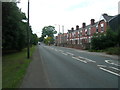
2
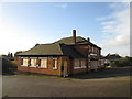
Chillis2 no more
Former pub, now a former restaurant, on Park Road Conisbrough
Image: © John Slater
Taken: 12 Nov 2013
0.10 miles
3
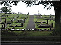
Cemetery Through Trees
The cemetery in Conisbrough stands by the side of the busy A631.
Image: © Michael Patterson
Taken: 6 Oct 2006
0.17 miles
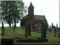
6
Ellershaw Lane from Lewes Road Conisbrough
Image: © Steve Fareham
Taken: 12 Feb 2008
0.23 miles