
IMAGES TAKEN NEAR TO
Edlington Lane, DONCASTER, DN12 1BX
Introduction
This page details the photographs taken nearby to Edlington Lane, DN12 1BX by members of the Geograph project.
The Geograph project started in 2005 with the aim of publishing, organising and preserving representative images for every square kilometre of Great Britain, Ireland and the Isle of Man.

There are currently over 7.5m images from over14,400 individuals and you can help contribute to the project by visiting https://www.geograph.org.uk
Image Map
Images are licensed for reuse under creativecommons.org/licenses/by-sa/2.0
Notes
- Clicking on the map will re-center to the selected point.
- The higher the marker number, the further away the image location is from the centre of the postcode.
Image Listing (3 Images Found)
Images are licensed for reuse under creativecommons.org/licenses/by-sa/2.0
Image
Details
Distance
1
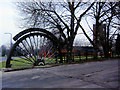
Winding wheel from Yorkshire Main Colliery 1911 to 1985
In the background is the fire station and the wheel is at the entrance to the Yorkshire Main miners welfare club Edlington Doncaster.
Image: © Steve Fareham
Taken: 19 Dec 2007
0.23 miles
2
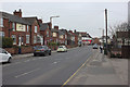
Edlington Lane, Edlington
Viewed from outside the Royal British Legion.
Image: © Mark Anderson
Taken: 23 Mar 2016
0.25 miles
3
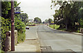
Edlington (Doncaster): site of former station/halt, 1992
View southward on the B6376 Warmsworth - Maltby road. The Halt had been on the left and was the terminus of the local service run until 10/9/51 from Wakefield on the ex-L&Y Dearne Valley mineral line, which continued to Black Carr and Bessacarr Junctions on the ex-GNR until 1966.
Image: © Ben Brooksbank
Taken: 21 Jun 1992
0.25 miles