IMAGES TAKEN NEAR TO
Victoria Road, DONCASTER, DN12 1BQ
Introduction
This page details the photographs taken nearby to Victoria Road, DN12 1BQ by members of the Geograph project.
The Geograph project started in 2005 with the aim of publishing, organising and preserving representative images for every square kilometre of Great Britain, Ireland and the Isle of Man.

There are currently over 7.5m images from over14,400 individuals and you can help contribute to the project by visiting https://www.geograph.org.uk
Image Map
Images are licensed for reuse under creativecommons.org/licenses/by-sa/2.0
Notes
- Clicking on the map will re-center to the selected point.
- The higher the marker number, the further away the image location is from the centre of the postcode.
Image Listing (7 Images Found)
Images are licensed for reuse under creativecommons.org/licenses/by-sa/2.0
Image
Details
Distance
1

Bogies beside Warmsworth Halt
An industrial unit on the outskirts of Doncaster along the route of the former Dearne Valley Railway.
Image: © DS Pugh
Taken: 13 Apr 2025
0.19 miles
2

Cycle path emerging onto Warmsworth Halt
The path runs along the course of the former Dearne Valley Railway.
Image: © DS Pugh
Taken: 13 Apr 2025
0.21 miles
3
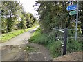
The start of the trail to Conisbrough
Image: © Steve Fareham
Taken: 24 Sep 2014
0.21 miles
4

Trail bikes emerging onto Warmsworth Halt
Around a dozen bikes exited the field on the left and headed along the road.
Image: © DS Pugh
Taken: 13 Apr 2025
0.21 miles
5
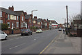
Edlington Lane, Edlington
Viewed from outside the Royal British Legion.
Image: © Mark Anderson
Taken: 23 Mar 2016
0.22 miles
6
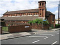
Red Brick Church
Sitting on the southern edge of this square both the church and the road are dedicated to St John. The blue sign points to a recreation ground.
Image: © Michael Patterson
Taken: 7 Jul 2006
0.22 miles