IMAGES TAKEN NEAR TO
Coronach Way, DONCASTER, DN11 0RL
Introduction
This page details the photographs taken nearby to Coronach Way, DN11 0RL by members of the Geograph project.
The Geograph project started in 2005 with the aim of publishing, organising and preserving representative images for every square kilometre of Great Britain, Ireland and the Isle of Man.

There are currently over 7.5m images from over14,400 individuals and you can help contribute to the project by visiting https://www.geograph.org.uk
Image Map
Images are licensed for reuse under creativecommons.org/licenses/by-sa/2.0
Notes
- Clicking on the map will re-center to the selected point.
- The higher the marker number, the further away the image location is from the centre of the postcode.
Image Listing (11 Images Found)
Images are licensed for reuse under creativecommons.org/licenses/by-sa/2.0
Image
Details
Distance
2
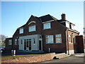
The White Rose, New Rossington
A Sam Smith's public house.
Image: © Ian S
Taken: 25 Nov 2011
0.18 miles
3
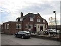
The White Rose, New Rossington
A Sam Smith's public house
Image: © Ian S
Taken: 25 Feb 2012
0.18 miles

5
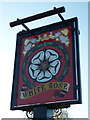
The White Rose, New Rossington
A Sam Smith's public house
Image: © Ian S
Taken: 25 Nov 2011
0.19 miles
7
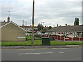
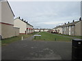
Radburn Road
The layout of this part of the development suggests that the name was given in recognition of the principles laid down in Radburn, New Jersey to create residential areas with segregated vehicle and pedestrian routes. Radburn is the spine route through the development. In practice, the estate design really only pays lip service to the principle, as there are many homes facing onto roads
Image: © Alan Murray-Rust
Taken: 22 Jul 2007
0.20 miles
9
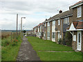
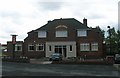
Bruni Way, front side
This part of New Rossington was built following the Radburn principle whereby vehicle and pedestrian routes in residential areas were segregated. The back of these houses looks like this: Image
Image: © Alan Murray-Rust
Taken: 22 Jul 2007
0.21 miles