
IMAGES TAKEN NEAR TO
Hunters Drive, DONCASTER, DN10 4QX
Introduction
This page details the photographs taken nearby to Hunters Drive, DN10 4QX by members of the Geograph project.
The Geograph project started in 2005 with the aim of publishing, organising and preserving representative images for every square kilometre of Great Britain, Ireland and the Isle of Man.

There are currently over 7.5m images from over14,400 individuals and you can help contribute to the project by visiting https://www.geograph.org.uk
Image Map
Images are licensed for reuse under creativecommons.org/licenses/by-sa/2.0
Notes
- Clicking on the map will re-center to the selected point.
- The higher the marker number, the further away the image location is from the centre of the postcode.
Image Listing (108 Images Found)
Images are licensed for reuse under creativecommons.org/licenses/by-sa/2.0
Image
Details
Distance
1
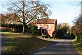
Primitive Methodist Chapel
Chapel of 1838 on Cross Hill, now a private house
Image: © Richard Croft
Taken: 6 Nov 2007
0.05 miles
2
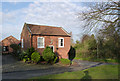
The old Primitive Methodist Chapel
Built in 1838, it was replaced by the larger adjacent chapel in 1886, becoming a Sunday School. Now converted to a private residence. The overhung corner, easing the curve of the road at ground level, appears to be an original feature. Listed Grade II.
There is a bench mark http://www.geograph.org.uk/photo/4242542 on the right hand end of the building.
Image: © Alan Murray-Rust
Taken: 9 Nov 2014
0.05 miles
3
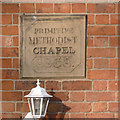
Datestone on the former Primitive Methodist chapel
This has an unusually stylish inscription. See http://www.geograph.org.uk/photo/4242536 for the chapel itself.
Image: © Alan Murray-Rust
Taken: 9 Nov 2014
0.05 miles
4
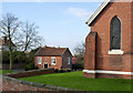
The two Methodist chapels, Gringley
Both belonged to the Primitive Methodist congregation, the newer http://www.geograph.org.uk/photo/4242532 in the foreground built in 1886 to replace the smaller 1838 chapel beyond http://www.geograph.org.uk/photo/4242536 , which then became a Sunday School.
After the Primitives rejoined the mainstream Methodists in 1932, the chapel continued in use alongside the existing Wesleyan chapel on High Street. The two congregations merged in 1958, using the former Primitive chapel which was in better condition of the pair.
Image: © Alan Murray-Rust
Taken: 9 Nov 2014
0.06 miles
5
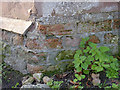
Bench mark, former Methodist Chapel, Gringley
Suffering the ravages of time. See http://www.geograph.org.uk/photo/4242536 for location.
Image: © Alan Murray-Rust
Taken: 9 Nov 2014
0.06 miles
6
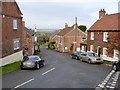
Cross Hill
Looking down to the plain of the Trent and Ouse.
Image: © Alan Murray-Rust
Taken: 9 Nov 2014
0.06 miles
7
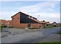
Gringley on the Hill Community Centre
Built in conjunction with new housing development on the site of the former H M Detention Centre. despite the laying of the foundation stone in 2011, legal complications delayed the opening until October 2014. It is a great improvement on the old village hall on High Street http://www.geograph.org.uk/photo/4242517.
Image: © Alan Murray-Rust
Taken: 9 Nov 2014
0.06 miles
8
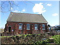
Former Chapel at Gringley-on-the-Hill
Work in progress inside, possibly conversion to house
Image: © John Slater
Taken: 23 Feb 2016
0.07 miles
9
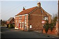
Cross Hill
Acorn House with Gringley Methodist Church beyond.
Image: © Graham Hogg
Taken: 9 Apr 2013
0.07 miles
