
IMAGES TAKEN NEAR TO
Mill Road, DONCASTER, DN10 4QT
Introduction
This page details the photographs taken nearby to Mill Road, DN10 4QT by members of the Geograph project.
The Geograph project started in 2005 with the aim of publishing, organising and preserving representative images for every square kilometre of Great Britain, Ireland and the Isle of Man.

There are currently over 7.5m images from over14,400 individuals and you can help contribute to the project by visiting https://www.geograph.org.uk
Image Map
Images are licensed for reuse under creativecommons.org/licenses/by-sa/2.0
Notes
- Clicking on the map will re-center to the selected point.
- The higher the marker number, the further away the image location is from the centre of the postcode.
Image Listing (111 Images Found)
Images are licensed for reuse under creativecommons.org/licenses/by-sa/2.0
Image
Details
Distance
1
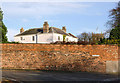
Gringley Hall
Hiding behind its high wall, the Hall dates from around 1800, with later additions. The house is Listed Grade II, the listing including the bounding wall and gateway.
Image: © Alan Murray-Rust
Taken: 9 Nov 2014
0.01 miles
2
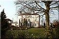
Gringley Hall
This 18th century house now offers bed and breakfast accommodation.
Image: © Graham Hogg
Taken: 9 Apr 2013
0.02 miles
4
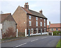
Smith's House
Originally built late 18th century with three bays, the nearest bay added in the 19th century and later converted to a separate dwelling. It now appears to occupied again as a single dwelling. Listed Grade II.
Image: © Alan Murray-Rust
Taken: 9 Nov 2014
0.02 miles
5
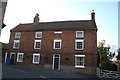
High Street
Handsome early 19th century house in Gringley-on-the-Hill
Image: © Richard Croft
Taken: 6 Nov 2007
0.03 miles
6
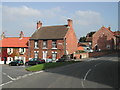
Top of Cross Hill, Gringley on the Hill
Gringley-on-the-Hill is a delightful village and parish, on the highest part of the road from Bawtry to Gainsborough, six miles east-south-east of the former, and the same distance west by north of the latter town. From its situation on the loftiest of the promontories which overlook the wide extent of Misson and Misterton Cars, it commands such extensive prospects, that the minsters of York, Lincoln and Beverley may be seen from it on a clear day, across the vales of the Trent and the Idle, whilst in the nearer distance, the Chesterfield Canal appears emerging from the tunnel at Drakeholes, and winding under the long ridge of hills which extends eastward to the Trent.
Image: © Tom Courtney
Taken: 16 Oct 2005
0.03 miles
7

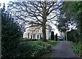
Gateway to Gringley Hall
The Hall can be vaguely discerned through the branches of a fine beech tree. The house is Listed Grade II, the listing including the surrounding wall and these gates.
Image: © Alan Murray-Rust
Taken: 9 Nov 2014
0.03 miles
8
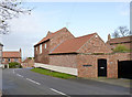
Former coach house to The Old Rectory
This is the taller part of the building, early 19th century, the nearer extension being modern. The coach house retains the high level opening to the hayloft on the upper floor. Listed Grade II for group value.
Image: © Alan Murray-Rust
Taken: 9 Nov 2014
0.03 miles
9
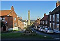
Gringley on the Hill's market cross
The village's market charter was granted in 1252 though of course the cross is not as old as that. It was restored in 2000 with funds from the local community to mark the beginning of this millennium.
Image: © Neil Theasby
Taken: 19 Nov 2020
0.04 miles
10
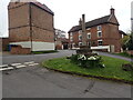
The old village cross, Gringley on the Hill
As its name implies, Gringley on the Hill is above the surrounding land and this is particularly the case compared to the flat carrs to the north. This is on Cross Hill which leads up to the Churchyard of St Peter and St Paul.
Image: © Marathon
Taken: 21 Apr 2023
0.04 miles