
Top of Cross Hill, Gringley on the Hill
Introduction
The photograph on this page of Top of Cross Hill, Gringley on the Hill by Tom Courtney as part of the Geograph project.
The Geograph project started in 2005 with the aim of publishing, organising and preserving representative images for every square kilometre of Great Britain, Ireland and the Isle of Man.

There are currently over 7.5m images from over 14,400 individuals and you can help contribute to the project by visiting https://www.geograph.org.uk
Top of Cross Hill, Gringley on the Hill
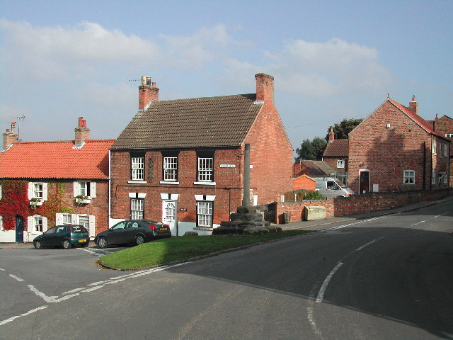
Image: © Tom Courtney Taken: 16 Oct 2005
Gringley-on-the-Hill is a delightful village and parish, on the highest part of the road from Bawtry to Gainsborough, six miles east-south-east of the former, and the same distance west by north of the latter town. From its situation on the loftiest of the promontories which overlook the wide extent of Misson and Misterton Cars, it commands such extensive prospects, that the minsters of York, Lincoln and Beverley may be seen from it on a clear day, across the vales of the Trent and the Idle, whilst in the nearer distance, the Chesterfield Canal appears emerging from the tunnel at Drakeholes, and winding under the long ridge of hills which extends eastward to the Trent.
Images are licensed for reuse under creativecommons.org/licenses/by-sa/2.0
Image Location

Latitude
53.407108
Longitude
-0.89584