IMAGES TAKEN NEAR TO
Broad Close, LEYBURN, DL8 3HE

Introduction

This page details the photographs taken nearby to Broad Close, DL8 3HE by members of the Geograph project.

The Geograph project started in 2005 with the aim of publishing, organising and preserving representative images for every square kilometre of Great Britain, Ireland and the Isle of Man.

There are currently over 7.5m images from over14,400 individuals and you can help contribute to the project by visiting https://www.geograph.org.uk

Image Map


Images are licensed for reuse under creativecommons.org/licenses/by-sa/2.0
Notes
  • Clicking on the map will re-center to the selected point.
  • The higher the marker number, the further away the image location is from the centre of the postcode.

Image Listing (190 Images Found)

Images are licensed for reuse under creativecommons.org/licenses/by-sa/2.0
  • ...
Image
Details
Distance
1
Askrigg Tiny Library
This is the Halloween display in the Askrigg Tiny Library - see https://www.geograph.org.uk/photo/7338476
Image: © Marathon Taken: 27 Oct 2022
0.01 miles
2
Calf grazing at Askrigg
Image: © philandju Taken: 10 Sep 2015
0.02 miles
3
Askrigg Tiny Library
This rather novel idea is found on the side of Mill Lane. I assume the display is changed according to the time of year. On 27th October the display in the case was Halloween - see https://www.geograph.org.uk/photo/7338479 for a close up of the inside of the display.
Image: © Marathon Taken: 27 Oct 2022
0.03 miles
4
A circular walk around Askrigg [1]
The walk leave Askrigg village along Mill Lane. From Askrigg village, the route goes northwest following Whitfield Gill upstream, passing Mill Gill Force and Whitfield Gill Lower Falls to reach Whitfield Gill Force. Then a return to Whitfield Gill Lower Falls to cross the gill before ascending to Low Straights Lane. The lane is followed eastwards for some distance before a turn south takes a path across fields to return to the starting point. About 3½ miles.
Image: © Michael Dibb Taken: 22 Jun 2022
0.04 miles
5
Footpath to Askrigg
St Oswald's Church can clearly be seen amongst the houses of the village of Askrigg. See https://www.geograph.org.uk/photo/7335989
Image: © Marathon Taken: 27 Oct 2022
0.06 miles
6
Mill Lane, Askrigg
Image: © P Gaskell Taken: 12 Oct 2004
0.06 miles
7
Three-wheelers at Askrigg
A pair of Reliant Robins http://en.wikipedia.org/wiki/Reliant_Robin
Image: © Karl and Ali Taken: 14 Sep 2014
0.06 miles
8
Young cattle grazing at Askrigg
Image: © philandju Taken: 10 Sep 2015
0.06 miles
9
Sheep shearing at the back of Askrigg
Two dogs keep the flock penned into the field corner while the farmer gets on with the shearing.
Image: © Karl and Ali Taken: 8 Jul 2012
0.06 miles
10
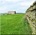
A Wensleydale wall
This drystone wall is typical of Wensleydale, being constructed with two lines of 'throughs', stones which are laid right through the wall from one side to the other to add strength and stability. The same pattern can be seen on the field barn further up the hill.
Image: © Gordon Hatton Taken: 16 Aug 2016
0.08 miles
  • ...