A Wensleydale wall
Introduction
The photograph on this page of A Wensleydale wall by Gordon Hatton as part of the Geograph project.
The Geograph project started in 2005 with the aim of publishing, organising and preserving representative images for every square kilometre of Great Britain, Ireland and the Isle of Man.

There are currently over 7.5m images from over 14,400 individuals and you can help contribute to the project by visiting https://www.geograph.org.uk
A Wensleydale wall
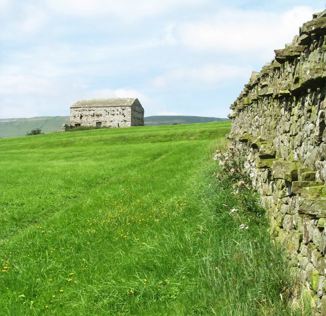
Image: © Gordon Hatton Taken: 16 Aug 2016
This drystone wall is typical of Wensleydale, being constructed with two lines of 'throughs', stones which are laid right through the wall from one side to the other to add strength and stability. The same pattern can be seen on the field barn further up the hill.
Images are licensed for reuse under creativecommons.org/licenses/by-sa/2.0
Image Location
Latitude
54.316808
Longitude
-2.084974