IMAGES TAKEN NEAR TO
Low Street, NORTHALLERTON, DL7 9LU
Introduction
This page details the photographs taken nearby to Low Street, DL7 9LU by members of the Geograph project.
The Geograph project started in 2005 with the aim of publishing, organising and preserving representative images for every square kilometre of Great Britain, Ireland and the Isle of Man.

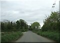
There are currently over 7.5m images from over14,400 individuals and you can help contribute to the project by visiting https://www.geograph.org.uk
Image Map
Images are licensed for reuse under creativecommons.org/licenses/by-sa/2.0
Notes
- Clicking on the map will re-center to the selected point.
- The higher the marker number, the further away the image location is from the centre of the postcode.
Image Listing (14 Images Found)
Images are licensed for reuse under creativecommons.org/licenses/by-sa/2.0
Image
Details
Distance
1
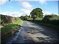
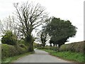
Low Street
Looking towards Stone Mole House.
Image: © Christine Johnstone
Taken: 24 Aug 2010
0.09 miles
2
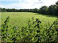
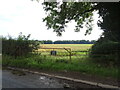
Green field, green hedgerows
Just off Low Street.
Image: © Christine Johnstone
Taken: 24 Aug 2010
0.09 miles
3
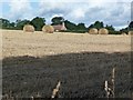
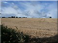
Swiss rolls in a field off Low Street
The roof of Low Leases Farm is just in front of the trees.
Image: © Christine Johnstone
Taken: 24 Aug 2010
0.09 miles
4
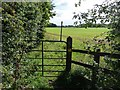
Footpath to Scruton
Taken from Low Street.
Image: © Christine Johnstone
Taken: 24 Aug 2010
0.10 miles
5
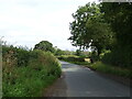
Low Street
A minor road of some antiquity that runs parallel to the Great North Road [now A1(M)] for several miles between Leeming and Catterick.
Image: © Gordon Hatton
Taken: 7 Apr 2021
0.11 miles
6
After the harvest
Stubble field off Low Street.
Image: © Christine Johnstone
Taken: 24 Aug 2010
0.13 miles
8
Low Street
National Cycle Route 71 towards Little Fencote.
Image: © JThomas
Taken: 24 Jul 2020
0.17 miles
9
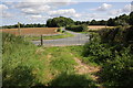
Road and bridleway junctions on Low Street
Fence Dike Lane left to Scruton, right bridleway to the A1, I am assuming it is little used!
Image: © Martin Dawes
Taken: 24 Apr 2024
0.18 miles
10
Footpath and road junctions with Low Street
The road ahead is Fence Dike Lane
Image: © Roger Templeman
Taken: 2 Sep 2012
0.19 miles