IMAGES TAKEN NEAR TO
Little Fencote, NORTHALLERTON, DL7 9LP
Introduction
This page details the photographs taken nearby to DL7 9LP by members of the Geograph project.
The Geograph project started in 2005 with the aim of publishing, organising and preserving representative images for every square kilometre of Great Britain, Ireland and the Isle of Man.

There are currently over 7.5m images from over14,400 individuals and you can help contribute to the project by visiting https://www.geograph.org.uk
Image Map
Images are licensed for reuse under creativecommons.org/licenses/by-sa/2.0
Notes
- Clicking on the map will re-center to the selected point.
- The higher the marker number, the further away the image location is from the centre of the postcode.
Image Listing (13 Images Found)
Images are licensed for reuse under creativecommons.org/licenses/by-sa/2.0
Image
Details
Distance
1
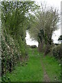
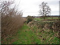
Crank Lane - a path to nowhere?
Crank Lane is now a public footpath, but is shown as a bridle road on first edition OS maps. Long ago it linked with Leeming Lane, the old Great North Road which is now a three lane motorway. Some current OS maps show the lane terminating at the edge of the motorway, but there is now an alternative to left or right along a recently created bridleway that runs parallel to the A1(M).
Image: © Gordon Hatton
Taken: 7 Apr 2021
0.13 miles
2
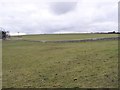
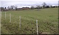
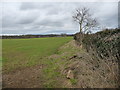
Farmland north of Gunhill Plantation
About 50 metres above sea level.
Image: © Christine Johnstone
Taken: 23 Mar 2018
0.14 miles
3
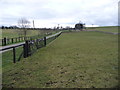
Private drive to the house at Gunhill Plantation
Running south-west from Low Street.
Image: © Christine Johnstone
Taken: 23 Mar 2018
0.16 miles
4
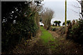
Crank Lane
Public footpath headind west towards the A1
Image: © Chris Heaton
Taken: 20 Feb 2017
0.17 miles
5
Public footpath descending towards Little Fencote
This public footpath routes NE from the A1 and descends into the hamlet of Little Fencote.
Image: © Frank Glover
Taken: 16 Mar 2007
0.19 miles
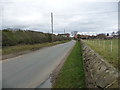
6
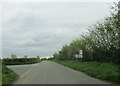
Low Street at the Todd Lane junction
South toward Leeming
Image: © Martin Dawes
Taken: 24 Apr 2024
0.21 miles
7
Low Street
Looking north from the junction with Todd Lane
Image: © Chris Heaton
Taken: 20 Feb 2017
0.21 miles
8
Buildings at Salutation Farm
On the west side of Low Street.
Image: © Christine Johnstone
Taken: 23 Mar 2018
0.23 miles
9
Farmland north-west of Salutation Farm
On the east side of Low Street.
Image: © Christine Johnstone
Taken: 23 Mar 2018
0.23 miles
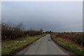
10
Low Street heading south to Salutation Farm
There is a 41 metre spot height at the distant road junction.
Image: © Christine Johnstone
Taken: 23 Mar 2018
0.24 miles