IMAGES TAKEN NEAR TO
Osmotherley, NORTHALLERTON, DL6 3QA
Introduction
This page details the photographs taken nearby to DL6 3QA by members of the Geograph project.
The Geograph project started in 2005 with the aim of publishing, organising and preserving representative images for every square kilometre of Great Britain, Ireland and the Isle of Man.

There are currently over 7.5m images from over14,400 individuals and you can help contribute to the project by visiting https://www.geograph.org.uk
Image Map
Images are licensed for reuse under creativecommons.org/licenses/by-sa/2.0
Notes
- Clicking on the map will re-center to the selected point.
- The higher the marker number, the further away the image location is from the centre of the postcode.
Image Listing (45 Images Found)
Images are licensed for reuse under creativecommons.org/licenses/by-sa/2.0
Image
Details
Distance
1
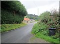
Osmotherley, Finklegates
According to the OS benchmark database there is a benchmark cut into a ruin on the north west side of the road. There has been redevelopment and new build in this location, and no benchmark was found.
Image: © Mel Towler
Taken: 3 Apr 2023
0.01 miles
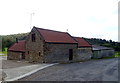
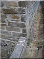
2
Barn, Woodside Farm
On the barn wall is an Ordnance Survey bench mark.
Image: © Maigheach-gheal
Taken: 7 Oct 2010
0.04 miles
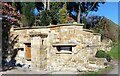
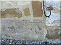
3
Ordnance Survey Cut Mark
This OS cut mark can be found on the roadside building at Woodside Farm. It marks a point 170.517m above mean sea level.
Image: © Adrian Dust
Taken: 1 Dec 2017
0.05 miles
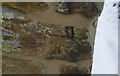
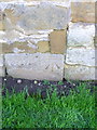
4
Cut benchmark
Bench mark on corner of farm building
Image: © Michael Rye
Taken: 7 May 2017
0.05 miles
5
Bench Mark, Woodside Farm
The bench mark is on the barn wall which is along side the road. For a wider view Image and for further information on the bench mark http://www.bench-marks.org.uk/bm36024
Image: © Maigheach-gheal
Taken: 7 Oct 2010
0.05 miles
6
Osmotherley, Woodside Farm
The benchmark is cut into the north-west facing wall of the converted buildings.
Image: © Mel Towler
Taken: 3 Apr 2023
0.05 miles
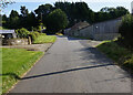
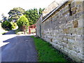
8
Burnthouse Bank from junction of Green Lane
Image: © Martin Dawes
Taken: 25 Sep 2019
0.06 miles
9
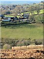
Woodside Farm
A view across the valley from the path that descends into Oak Dale from Chequers.
Image: © Gordon Hatton
Taken: 27 Jan 2022
0.06 miles