IMAGES TAKEN NEAR TO
Staindrop, DARLINGTON, DL2 3AW
Introduction
This page details the photographs taken nearby to DL2 3AW by members of the Geograph project.
The Geograph project started in 2005 with the aim of publishing, organising and preserving representative images for every square kilometre of Great Britain, Ireland and the Isle of Man.

There are currently over 7.5m images from over14,400 individuals and you can help contribute to the project by visiting https://www.geograph.org.uk
Image Map
Images are licensed for reuse under creativecommons.org/licenses/by-sa/2.0
Notes
- Clicking on the map will re-center to the selected point.
- The higher the marker number, the further away the image location is from the centre of the postcode.
Image Listing (18 Images Found)
Images are licensed for reuse under creativecommons.org/licenses/by-sa/2.0
Image
Details
Distance
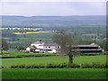
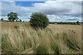
2

Field towards Low Keverstone
From a footpath which runs between the B6279 Staindrop to Ingleton road to Wackerfield.
Image: © DS Pugh
Taken: 24 Aug 2022
0.15 miles
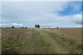
3

Footpath near Low Keverstone
The footpath runs between the B6279 Staindrop to Ingleton road to Wackerfield.
Image: © DS Pugh
Taken: 24 Aug 2022
0.17 miles
4

Stile near Low Keverstone
The footpath runs between the B6279 Staindrop to Ingleton road to Wackerfield.
Image: © DS Pugh
Taken: 24 Aug 2022
0.17 miles
5
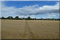
Path through an arable field
The footpath runs between the B6279 Staindrop to Ingleton road to Wackerfield.
Image: © DS Pugh
Taken: 24 Aug 2022
0.18 miles
6
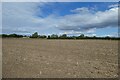
Footpath crossing a field near Low Keverstone
The footpath runs between the B6279 Staindrop to Ingleton road to Wackerfield.
Image: © DS Pugh
Taken: 24 Aug 2022
0.18 miles
7
Footpath and field gap
The footpath runs between the B6279 Staindrop to Ingleton road to Wackerfield.
Image: © DS Pugh
Taken: 24 Aug 2022
0.19 miles
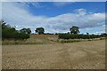
8
Hedgerow between fields
Looking along a field boundary near the footpath which runs between the B6279 Staindrop to Ingleton road to Wackerfield.
Image: © DS Pugh
Taken: 24 Aug 2022
0.19 miles
9
Track towards Low Keverstone
Looking along a farm track near the village of Wackerfield.
Image: © DS Pugh
Taken: 24 Aug 2022
0.21 miles
10

Footpath marker East of Low Keverstone
The footpath runs between the B6279 Staindrop to Ingleton road to Wackerfield.
Image: © DS Pugh
Taken: 24 Aug 2022
0.22 miles