IMAGES TAKEN NEAR TO
Gudmunsen Avenue, BISHOP AUCKLAND, DL14 6RG
Introduction
This page details the photographs taken nearby to Gudmunsen Avenue, DL14 6RG by members of the Geograph project.
The Geograph project started in 2005 with the aim of publishing, organising and preserving representative images for every square kilometre of Great Britain, Ireland and the Isle of Man.

There are currently over 7.5m images from over14,400 individuals and you can help contribute to the project by visiting https://www.geograph.org.uk
Image Map
Images are licensed for reuse under creativecommons.org/licenses/by-sa/2.0
Notes
- Clicking on the map will re-center to the selected point.
- The higher the marker number, the further away the image location is from the centre of the postcode.
Image Listing (18 Images Found)
Images are licensed for reuse under creativecommons.org/licenses/by-sa/2.0
Image
Details
Distance
1
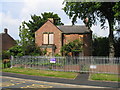
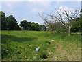
Derelict House on the corner of the former Tindale Crescent Hospital site
Image: © RedCitrus
Taken: 6 Jun 2006
0.04 miles
3
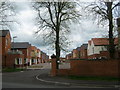
Bishopfield Tindale Crescent County Durham
Recent housing development in Greenfield Road on site of the demolished Tindale Crescent Hospital. The former entrance has been bricked up with this new entrance made a short distance up the road and the established trees retained.
Image: © Peter Robinson
Taken: 29 Apr 2010
0.08 miles
4
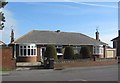
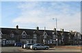
Bungalows in Greenfields Road, Tindale Crescent
Built in the late 1930's, the only bungalows in the village and until the 1950's detached from the terraced housing
Image: © Peter Robinson
Taken: 2 Mar 2011
0.08 miles
5
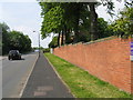
Tindale Crescent Hospital Site
The wall shown in the picture forms the boundary to the former Tindale Crescent Hospital (now demolished) on the western outskirts of Bishop Auckland. Originally a Victorian isolation hospital, the building was in use until 2002 and has now been handed over to the government's development agency English Partnerships for redevelopment.
Image: © RedCitrus
Taken: 6 Jun 2006
0.10 miles
6
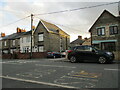
St Helen Auckland, A688 Junction with Greenfields Road
Image: © David Dixon
Taken: 24 Jun 2011
0.11 miles
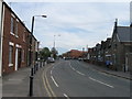
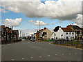
7

Road entering Tindale Crescent
The name Tindale Crescent suggests a residential street rather than the urban village that it is; it lies adjacent to the larger town of Bishop Auckland.
The blue and yellow road sign is in the colours and style introduced in County Durham some years ago.
Image: © Trevor Littlewood
Taken: 4 Jul 2013
0.13 miles