IMAGES TAKEN NEAR TO
Southside, Butterknowle, BISHOP AUCKLAND, DL13 5JX
Introduction
This page details the photographs taken nearby to DL13 5JX by members of the Geograph project.
The Geograph project started in 2005 with the aim of publishing, organising and preserving representative images for every square kilometre of Great Britain, Ireland and the Isle of Man.

There are currently over 7.5m images from over14,400 individuals and you can help contribute to the project by visiting https://www.geograph.org.uk
Image Map (Loading...)


Getting Data...Please wait
Leaflet Map data © OpenStreetMap
Images are licensed for reuse under creativecommons.org/licenses/by-sa/2.0
Notes
- Clicking on the map will re-center to the selected point.
- The higher the marker number, the further away the image location is from the centre of the postcode.
Image Listing (10 Images Found)
Images are licensed for reuse under creativecommons.org/licenses/by-sa/2.0
Image
Details
Distance
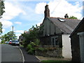
4
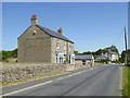
Rambling into South Side
From the south west entering the hamlet near Butterknowle in County Durham
Image: © Peter Robinson
Taken: 2 Aug 2009
0.08 miles
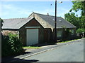
5
2 pm in South Side
Attractive clock with gargoyles either side seen in this hamlet in County Durham
Image: © Peter Robinson
Taken: 2 Aug 2009
0.09 miles
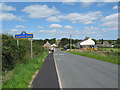
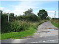
6
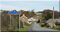
Road entering South Side
South Side is a small settlement of scattered properties in the Butterknowle area of County Durham. The blue and yellow road sign is in a style introduced in County Durham some years ago.
Image: © Trevor Littlewood
Taken: 30 Nov 2013
0.10 miles
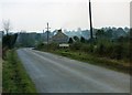
7
Loop Lane entering South Side
Looking north-eastward.
Image: © Peter Wood
Taken: 25 Mar 2017
0.14 miles
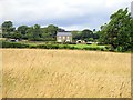
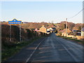
9
Footpath to Potter's Cross
Near Butterknowle in County Durham a Public Right of Way on the drive to this remote hamlet.
Image: © Peter Robinson
Taken: 2 Aug 2009
0.21 miles
10
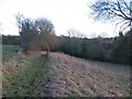
Bridleway at South Side
Bridleway heading down into the valley below South Side. A check on old OS maps would suggest that this is also the line of a former colliery tramway.
Image: © Gordon Hatton
Taken: 19 Feb 2012
0.24 miles