IMAGES TAKEN NEAR TO
Front Street, BISHOP AUCKLAND, DL13 1BQ
Introduction
This page details the photographs taken nearby to Front Street, DL13 1BQ by members of the Geograph project.
The Geograph project started in 2005 with the aim of publishing, organising and preserving representative images for every square kilometre of Great Britain, Ireland and the Isle of Man.

There are currently over 7.5m images from over14,400 individuals and you can help contribute to the project by visiting https://www.geograph.org.uk
Image Map
Images are licensed for reuse under creativecommons.org/licenses/by-sa/2.0
Notes
- Clicking on the map will re-center to the selected point.
- The higher the marker number, the further away the image location is from the centre of the postcode.
Image Listing (65 Images Found)
Images are licensed for reuse under creativecommons.org/licenses/by-sa/2.0
Image
Details
Distance
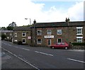
2
Wearhead
The A689 running through the small village of Wearhead
Image: © Chris Heaton
Taken: 17 May 2022
0.01 miles
3
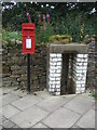
Elizabeth II postbox on Front Street, Wearhead
Postbox No. DL13 123.
See Image] for context.
Image: © JThomas
Taken: 24 Aug 2017
0.02 miles
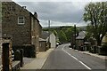
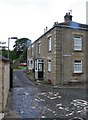
4
Front Street, Wearhead
Showing position of Postbox No. DL13 123.
See Image] for postbox.
Image: © JThomas
Taken: 24 Aug 2017
0.02 miles
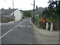
5
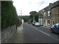
Front Street (A689), Wearhead
Looking south east.
Image: © JThomas
Taken: 24 Aug 2017
0.02 miles
7
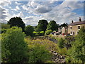
Source of the River Wear; confluence of Killhope and Burnhope burns, Wearhead
Image: © Andrew Jackson
Taken: 30 Aug 2018
0.03 miles
9
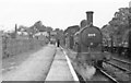
Wearhead station and train for Bishop Auckland on Last Day, 1953
View NW to buffers, with train headed by ex-NER Worsdell class C LNER J21 No. 65078 (built 4/1891 as No. 1554, renumbered in 1946 as 5078, withdrawn as BR 65078 in 2/57). The branch was closed completely to Wearhead that day (27/6/53), but remained open for goods as far as St Johns Chapel until 2/1/61. (See also my Image).
Image: © Walter Dendy, deceased
Taken: 27 Jun 1953
0.03 miles
10
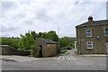
Public convenience, Wearhead
The villages of Weardale are well supplied with free toilets.
Image: © Tim Heaton
Taken: 17 May 2022
0.03 miles