IMAGES TAKEN NEAR TO
Tunstall, RICHMOND, DL10 7RA
Introduction
This page details the photographs taken nearby to DL10 7RA by members of the Geograph project.
The Geograph project started in 2005 with the aim of publishing, organising and preserving representative images for every square kilometre of Great Britain, Ireland and the Isle of Man.

There are currently over 7.5m images from over14,400 individuals and you can help contribute to the project by visiting https://www.geograph.org.uk
Image Map (Loading...)


Getting Data...Please wait
Leaflet Map data © OpenStreetMap
Images are licensed for reuse under creativecommons.org/licenses/by-sa/2.0
Notes
- Clicking on the map will re-center to the selected point.
- The higher the marker number, the further away the image location is from the centre of the postcode.
Image Listing (15 Images Found)
Images are licensed for reuse under creativecommons.org/licenses/by-sa/2.0
Image
Details
Distance
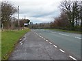
2
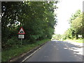
Caution tanks turning
On Craggs Lane near Catterick
Image: © Ian S
Taken: 26 Aug 2012
0.11 miles
3
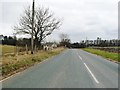
Hawkswell Lane, looking east
There is a 179 metre spot height here, and a civil parish boundary along the left / north verge. The road is in Hunton civil parish, the house in Scotton.
Image: © Christine Johnstone
Taken: 26 Feb 2018
0.15 miles
4
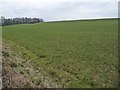
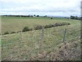
Farmland between Hawkswell Lane and Craggs Lane
Looking east. About 180 metres above sea level.
Image: © Christine Johnstone
Taken: 26 Feb 2018
0.16 miles
5
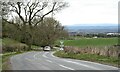
Junction of Craggs Lane and Moor Lane
Image: © Roger Templeman
Taken: 30 May 2016
0.16 miles
6
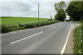
Moor Lane dropping to Tunstall
Minor road heading down towards Tunstall and providing any cyclist with a pleasant couple of miles of freewheeling as the road drops from around 570ft to 325ft at the bottom of the village. The view is across the Vale of Mowbray to the distant line of the Cleveland Hills.
Image: © Gordon Hatton
Taken: 7 Apr 2021
0.18 miles
7
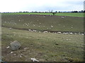
Valley field, full of sheep
On the north side of Hawkswell Lane.
Image: © Christine Johnstone
Taken: 26 Feb 2018
0.19 miles
8
Steep-sided little valley north of Hawkswell Lane
The stream flows east to become Tunstall Beck.
Image: © Christine Johnstone
Taken: 26 Feb 2011
0.20 miles
9
Hawkswell Lane
Approaching the junction with Bedale Road.
Image: © Christine Johnstone
Taken: 26 Feb 2011
0.20 miles
10
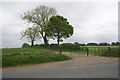
Field access track from Moor Lane
A widened gateway
Image: © Roger Templeman
Taken: 30 May 2016
0.22 miles