
IMAGES TAKEN NEAR TO
White Lands, RICHMOND, DL10 7DR
Introduction
This page details the photographs taken nearby to White Lands, DL10 7DR by members of the Geograph project.
The Geograph project started in 2005 with the aim of publishing, organising and preserving representative images for every square kilometre of Great Britain, Ireland and the Isle of Man.

There are currently over 7.5m images from over14,400 individuals and you can help contribute to the project by visiting https://www.geograph.org.uk
Image Map
Images are licensed for reuse under creativecommons.org/licenses/by-sa/2.0
Notes
- Clicking on the map will re-center to the selected point.
- The higher the marker number, the further away the image location is from the centre of the postcode.
Image Listing (6 Images Found)
Images are licensed for reuse under creativecommons.org/licenses/by-sa/2.0
Image
Details
Distance
1
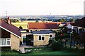
Looking south towards Whitefields Estate and Catterick Garrison, from Ronaldshay Drive, Richmond, North Yorkshire
Ronaldshay Drive had been built in the early 1960's. More houses were then being built on the fields of Whitefields Farm, but in 1971 at the western side only, to the right. The bounds of Richmond were beside the line of trees to the far left. The eastern side of the farm has since been built up, covering most of the green space heading towards the tree line. The field immediately behind this viewpoint has also been developed.
In these days my boss lived in a bungalow, the last house heading out of Richmond on the Darlington Road. The garden seems to have been sold off and more houses have gone in there - that too just within the Richmond bounds.
Catterick Garrison is just visible in the far distance right. That has grown substantially in the last 40 years and is now one of the biggest military bases in Europe. The growth of the army base and the growth of Richmond are not unrelated. Many soldiers buy houses in the area for when they leave the army, and many civilian jobs are created to help service the army personnel and their families.
Image: © Chris Morgan
Taken: Unknown
0.10 miles
2

St. Francis Xavier school, Richmond
Locally known merely as "SFX" it is one of a cluster of schools on the east side of Richmond which certainly do produce sound effects...
Image: © Andy Waddington
Taken: 17 Feb 2011
0.18 miles
3
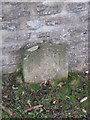
Old Boundary Marker by the B6271, Easby parish
Parish Boundary Marker by the B6271, in parish of Easby (Richmondshire District), a metre east of Scots Dyke, between public footpath and entrance to Sandford House, against stone wall.
Inscription reads:-
EASBY
ROAD ENDS
HERE
Grade II listed.
List Entry Number: 1131604 https://historicengland.org.uk/listing/the-list/list-entry/1131604
Surveyed
Milestone Society National ID: YN_RCDL01bpb
Image: © Milestone Society
Taken: Unknown
0.22 miles
4

Richmond School
Richmond School is a community comprehensive school situated on the edge of the beautiful Yorkshire Dales, based in the market town of Richmond. http://www.richmondschool.net/
Image: © Russel Wills
Taken: 8 Dec 2018
0.22 miles
5
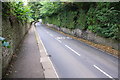
B6271 heading east along Maison Dieu
Image: © Roger Templeman
Taken: 23 Aug 2016
0.23 miles
6
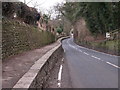
B6271, Richmond
Raised walkway at St. Nicholas leaving Richmond.
Image: © wfmillar
Taken: 28 Jan 2010
0.24 miles