Looking south towards Whitefields Estate and Catterick Garrison, from Ronaldshay Drive, Richmond, North Yorkshire
Introduction
The photograph on this page of Looking south towards Whitefields Estate and Catterick Garrison, from Ronaldshay Drive, Richmond, North Yorkshire by Chris Morgan as part of the Geograph project.
The Geograph project started in 2005 with the aim of publishing, organising and preserving representative images for every square kilometre of Great Britain, Ireland and the Isle of Man.

There are currently over 7.5m images from over 14,400 individuals and you can help contribute to the project by visiting https://www.geograph.org.uk
Looking south towards Whitefields Estate and Catterick Garrison, from Ronaldshay Drive, Richmond, North Yorkshire
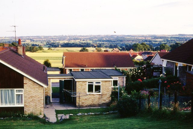
Image: © Chris Morgan Taken: Unknown
Ronaldshay Drive had been built in the early 1960's. More houses were then being built on the fields of Whitefields Farm, but in 1971 at the western side only, to the right. The bounds of Richmond were beside the line of trees to the far left. The eastern side of the farm has since been built up, covering most of the green space heading towards the tree line. The field immediately behind this viewpoint has also been developed. In these days my boss lived in a bungalow, the last house heading out of Richmond on the Darlington Road. The garden seems to have been sold off and more houses have gone in there - that too just within the Richmond bounds. Catterick Garrison is just visible in the far distance right. That has grown substantially in the last 40 years and is now one of the biggest military bases in Europe. The growth of the army base and the growth of Richmond are not unrelated. Many soldiers buy houses in the area for when they leave the army, and many civilian jobs are created to help service the army personnel and their families.
Images are licensed for reuse under creativecommons.org/licenses/by-sa/2.0
Image Location
Latitude
54.407364
Longitude
-1.716034