
IMAGES TAKEN NEAR TO
Harelaw Industrial Estate, North Road, STANLEY, DH9 8UX
Introduction
This page details the photographs taken nearby to Harelaw Industrial Estate, North Road, DH9 8UX by members of the Geograph project.
The Geograph project started in 2005 with the aim of publishing, organising and preserving representative images for every square kilometre of Great Britain, Ireland and the Isle of Man.

There are currently over 7.5m images from over14,400 individuals and you can help contribute to the project by visiting https://www.geograph.org.uk
Image Map
Images are licensed for reuse under creativecommons.org/licenses/by-sa/2.0
Notes
- Clicking on the map will re-center to the selected point.
- The higher the marker number, the further away the image location is from the centre of the postcode.
Image Listing (17 Images Found)
Images are licensed for reuse under creativecommons.org/licenses/by-sa/2.0
Image
Details
Distance
1
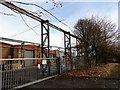
Crane gantry at Harelaw Industrial Estate
Gantry for an electrical overhead stockyard crane outside this factory building.
Image: © Robert Graham
Taken: 30 Nov 2016
0.07 miles
2
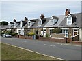
Unity Terrace
Neat terraced cottages on the B6168 at the south end of Flint Hill.
Image: © Oliver Dixon
Taken: 11 Jul 2022
0.07 miles
3
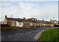
Bradley Terrace
These terraced bungalows on North Road in Dipton were originally built as Aged Miners Homes. Now privately owned.
Image: © Robert Graham
Taken: 30 Nov 2016
0.09 miles
4
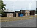
Doby Verrolec
Ductwork manufacturers on Harelaw Industrial Estate.
Image: © Oliver Dixon
Taken: 11 Jul 2022
0.11 miles
5
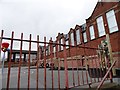
St Patrick's RC Primary School
On North Road, Dipton. There has been a Catholic school here since 1907.
Image: © Robert Graham
Taken: 9 Apr 2014
0.13 miles
6
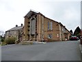
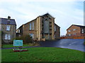
St Patrick's R C Church, Dipton
There has been a church here since 1929. This is the second one, built after the first burnt down in the late C20. The priest's house on the left survived the fire.
Image: © Robert Graham
Taken: 9 Apr 2014
0.13 miles
8
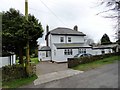
Stobilee House, Dipton
Large detached house on the lane which leads west from North Road to The Avenue. Presumably it takes its name from the nearby farm of Stob House.
Image: © Robert Graham
Taken: 9 Apr 2014
0.16 miles
9
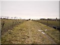
Track north of Stob House
The former Lily Colliery was just beyond the trees on the left. Few remains are now visible. The track here has the look of an old waggonway although is not marked on the maps and may just have been an access track. Just behind the photographer it joins the line of the Stob Waggonway Image
Image: © Andrew Curtis
Taken: 7 Jan 2011
0.20 miles
10
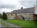
Buildings at Stob House, Dipton
Although this farm dates back to the mid C18 at least, a lot of the present buildings look younger than that. Of course, much modernisation will have taken place and some of the buildings may be older than they look.
Image: © Robert Graham
Taken: 9 Apr 2014
0.20 miles