
IMAGES TAKEN NEAR TO
Loud View Terrace, STANLEY, DH9 8PF
Introduction
This page details the photographs taken nearby to Loud View Terrace, DH9 8PF by members of the Geograph project.
The Geograph project started in 2005 with the aim of publishing, organising and preserving representative images for every square kilometre of Great Britain, Ireland and the Isle of Man.

There are currently over 7.5m images from over14,400 individuals and you can help contribute to the project by visiting https://www.geograph.org.uk
Image Map
Images are licensed for reuse under creativecommons.org/licenses/by-sa/2.0
Notes
- Clicking on the map will re-center to the selected point.
- The higher the marker number, the further away the image location is from the centre of the postcode.
Image Listing (10 Images Found)
Images are licensed for reuse under creativecommons.org/licenses/by-sa/2.0
Image
Details
Distance
1
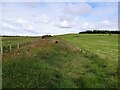
Field path to Loud Hill
Fields on the west side of Greencroft. Popular with local dog walkers.
Image: © Robert Graham
Taken: 20 Jul 2020
0.13 miles
2

Floral display, Greencroft
A pleasing floral display beside the A693 at Greencroft on the approach to Stanley.
Image: © Adrian Taylor
Taken: 10 Aug 2020
0.15 miles
3

Footpath entrance at Greencroft
The start of the path to Greencroft Heath from beside the Annfield Plain bypass. Picture taken after a light overnight snowfall.
Image: © Robert Graham
Taken: 12 Dec 2017
0.15 miles
4
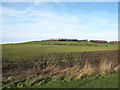
Slope rising towards Loud Reservoir
The reservoir lies at the top of the slope which is west of Greencroft, part of Annfield Plain.
Image: © Trevor Littlewood
Taken: 16 Dec 2013
0.16 miles
5

Ordnance Survey Flush Bracket S8503
This bracket can be found on the wall of the Community Centre.
For more detail see : http://www.bench-marks.org.uk/bm21225
Image: © Peter Wood
Taken: 18 May 2012
0.18 miles
6
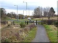
Consett and Sunderland Railway Path crossing Gorecock Lane
The Consett and Sunderland railway path is part of the famous C2C cycle route, National Cycle Network route 7. The main A693 road can be seen to the left. At this point, the line of the Stanhope and Tyne railway has been severed by the Annfield Plain bypass (constructed 1985). The path here diverts from the original line of the railway to pass through Greencroft Industrial Estate.
Image: © Oliver Dixon
Taken: 13 Nov 2012
0.18 miles
7

Looking across to Loud Hill
Looking north from the side of the main road at Greencroft. There is a new housing estate being built opposite Loud Terrace.
Image: © Robert Graham
Taken: 20 Jul 2020
0.20 miles
8
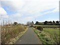
The railway path at Greencroft
Looking east along the Consett and Sunderland Railway Path towards the road junction at Greencroft, Annfield Plain.
Image: © Robert Graham
Taken: 30 Mar 2019
0.20 miles
9
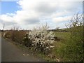
Blackthorn in flower beside the old railway
This scrub looks anything but black at this time of year. Quite a lot of it along this stretch of the Consett and Sunderland Railway Path, near Greencroft, Annfield Plain.
Image: © Robert Graham
Taken: 30 Mar 2019
0.22 miles
10
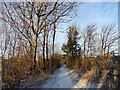
Snow covered path
A path through the little strip of woodland between the Annfield Plain bypass and the nearby Industrial Estate.
Image: © Robert Graham
Taken: 12 Dec 2017
0.24 miles