
IMAGES TAKEN NEAR TO
Percy Terrace, STANLEY, DH9 7TN
Introduction
This page details the photographs taken nearby to Percy Terrace, DH9 7TN by members of the Geograph project.
The Geograph project started in 2005 with the aim of publishing, organising and preserving representative images for every square kilometre of Great Britain, Ireland and the Isle of Man.

There are currently over 7.5m images from over14,400 individuals and you can help contribute to the project by visiting https://www.geograph.org.uk
Image Map
Images are licensed for reuse under creativecommons.org/licenses/by-sa/2.0
Notes
- Clicking on the map will re-center to the selected point.
- The higher the marker number, the further away the image location is from the centre of the postcode.
Image Listing (12 Images Found)
Images are licensed for reuse under creativecommons.org/licenses/by-sa/2.0
Image
Details
Distance
1
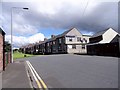
Langley Close, New Kyo
New Kyo is on the east side of Annfield Plain. A typical early C20 terrace. Note the working men's club on the end. They were once very common in this area, but a lot have closed in recent years.
Image: © Robert Graham
Taken: 12 Jul 2017
0.06 miles
2
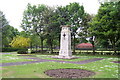
Annfield Plain War Memorial
War Memorial is located in the Annfield Plain Park. The monument commemorates WW1 and WW2.
Image: © John Charlton
Taken: 17 Jun 2006
0.07 miles
3
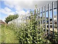
Iron railings
Around a used vehicle dealers in New Kyo, south of Shieldrow Lane. Looks fairly new. There's a nice collection of wild flowers, including Teasel. Suppose they would be weeds to most people.
Image: © Robert Graham
Taken: 12 Jul 2017
0.10 miles
4
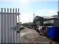
Used motor bikes
Beside Shieldrow Lane in New Kyo. Must admit, it's the first time I've ever seen a place dealing exclusively in second hand bikes.
Image: © Robert Graham
Taken: 12 Jul 2017
0.11 miles
5
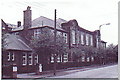
Annfield Plain Intermediate School, New Kyo
Girls school upstairs, boys school downstairs. Mr. Horsefield - Headmaster, Chemistry - Mr Dawson, Physics - Mr Boggon, French - Miss Jackson, PT - Mr Langford, History - Mr Graham, English - Miss Hislop.
Image: © John Charlton
Taken: 20 Aug 1994
0.14 miles
6
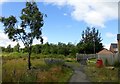
Scrubland behind new estate
This estate has been built on a brownfield site beside Shieldrow Lane in New Kyo. The land was previously occupied by terraced housing which was demolished nearly 40 years ago. I think the trees have self seeded for the most part, although some were planted.
Image: © Robert Graham
Taken: 12 Jul 2017
0.15 miles
7
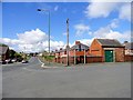
Shieldrow Lane, New Kyo
Looking west from the junction with Croft Terrace. Shieldrow Lane is the main road from Annfield Plain to Stanley. The houses of South View are on the right.
Image: © Robert Graham
Taken: 12 Jul 2017
0.17 miles
8

Seat beside the path
This public path runs across the section of land between Shieldrow Lane in New Kyo and the Annfield Plain bypass. It used to be a field path years ago, before the road was built.
Image: © Robert Graham
Taken: 12 Jul 2017
0.22 miles
10
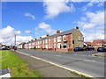
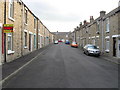
South View , New Kyo
New Kyo forms the eastern end of Annfield Plain. This is the west end of Shieldrow Lane, the main road to Stanley. This terrace is probably Edwardian in date, and with its curved brick soldier arches and door and window surrounds has an original look to it.
Image: © Robert Graham
Taken: 12 Jul 2017
0.23 miles