IMAGES TAKEN NEAR TO
Cookson Place, STANLEY, DH9 6YT
Introduction
This page details the photographs taken nearby to Cookson Place, DH9 6YT by members of the Geograph project.
The Geograph project started in 2005 with the aim of publishing, organising and preserving representative images for every square kilometre of Great Britain, Ireland and the Isle of Man.

There are currently over 7.5m images from over14,400 individuals and you can help contribute to the project by visiting https://www.geograph.org.uk
Image Map
Images are licensed for reuse under creativecommons.org/licenses/by-sa/2.0
Notes
- Clicking on the map will re-center to the selected point.
- The higher the marker number, the further away the image location is from the centre of the postcode.
Image Listing (9 Images Found)
Images are licensed for reuse under creativecommons.org/licenses/by-sa/2.0
Image
Details
Distance

2
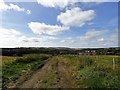
Looking down the track from Low Stanley
This was once the farm track to Low Stanley Farm, which is now gone. The view is south towards the housing estate at South Stanley. There is a nice view from here on the lower slopes below the town, which is also presumably the origin of the name.
Image: © Robert Graham
Taken: 16 Sep 2019
0.10 miles
3

Signboard and sculpture at Burnside
These are on the edge of the woods opposite Burnside Primary School at South Stanley.
Image: © Robert Graham
Taken: 16 Sep 2019
0.14 miles
4

Entrance to Burnside Primary School
This school is in a pleasant spot on the edge of the woods on the east side of a large housing estate at South Stanley.
Image: © Robert Graham
Taken: 16 Sep 2019
0.15 miles


8
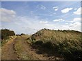
Site of Low Stanley
These grassed over hummocks in the field are all that remains of the old farmstead of Low Stanley. This is shown on the First Series O S map of 1861, before the town of Stanley existed. It is shown as a long linear range, which probably means it was 18th century in origin, if not earlier. It was still there on the 1921 map.
Image: © Robert Graham
Taken: 16 Sep 2019
0.24 miles