
IMAGES TAKEN NEAR TO
Darling Place, STANLEY, DH9 6XB
Introduction
This page details the photographs taken nearby to Darling Place, DH9 6XB by members of the Geograph project.
The Geograph project started in 2005 with the aim of publishing, organising and preserving representative images for every square kilometre of Great Britain, Ireland and the Isle of Man.

There are currently over 7.5m images from over14,400 individuals and you can help contribute to the project by visiting https://www.geograph.org.uk
Image Map
Images are licensed for reuse under creativecommons.org/licenses/by-sa/2.0
Notes
- Clicking on the map will re-center to the selected point.
- The higher the marker number, the further away the image location is from the centre of the postcode.
Image Listing (11 Images Found)
Images are licensed for reuse under creativecommons.org/licenses/by-sa/2.0
Image
Details
Distance

2

Footpath into South Stanley Wood
This is the western half of Stanley Wood, on the edge of the large housing estate of South Stanley. View is looking north along Durham Road.
Image: © Robert Graham
Taken: 12 Aug 2019
0.14 miles
3
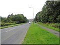
Looking north up Durham Road
This road runs from Stanley to Craghead. It bisects Stanley Wood up ahead here, and beyond is the large housing estate of South Stanley.
Image: © Robert Graham
Taken: 12 Aug 2019
0.15 miles


6
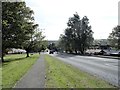
Looking down the length of Durham Road, South Stanley
The suburb of South Stanley occupies the hillside below the town centre. The first council houses were built here in the 1930's I believe, and further estates were built in the 40's and early 50's. More were added in the later 20th century.
Image: © Robert Graham
Taken: 16 Sep 2019
0.16 miles
7

Signboard and sculpture at Burnside
These are on the edge of the woods opposite Burnside Primary School at South Stanley.
Image: © Robert Graham
Taken: 16 Sep 2019
0.17 miles
8
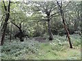
South Stanley Woods
This is the western half of Stanley Woods, an area of mostly secondary woodland along the Twizell (or Stanley) Burn. Now a Local Nature Reserve.
Image: © Robert Graham
Taken: 12 Aug 2019
0.19 miles
9

Entrance to Burnside Primary School
This school is in a pleasant spot on the edge of the woods on the east side of a large housing estate at South Stanley.
Image: © Robert Graham
Taken: 16 Sep 2019
0.20 miles
10
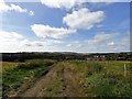
Looking down the track from Low Stanley
This was once the farm track to Low Stanley Farm, which is now gone. The view is south towards the housing estate at South Stanley. There is a nice view from here on the lower slopes below the town, which is also presumably the origin of the name.
Image: © Robert Graham
Taken: 16 Sep 2019
0.24 miles