
IMAGES TAKEN NEAR TO
Twizell Lane, STANLEY, DH9 6SQ
Introduction
This page details the photographs taken nearby to Twizell Lane, DH9 6SQ by members of the Geograph project.
The Geograph project started in 2005 with the aim of publishing, organising and preserving representative images for every square kilometre of Great Britain, Ireland and the Isle of Man.

There are currently over 7.5m images from over14,400 individuals and you can help contribute to the project by visiting https://www.geograph.org.uk
Image Map
Images are licensed for reuse under creativecommons.org/licenses/by-sa/2.0
Notes
- Clicking on the map will re-center to the selected point.
- The higher the marker number, the further away the image location is from the centre of the postcode.
Image Listing (22 Images Found)
Images are licensed for reuse under creativecommons.org/licenses/by-sa/2.0
Image
Details
Distance
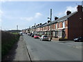
2
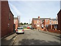
Plantation View, West Pelton
This is the street behind the long terrace of Twizell Lane. It consists of similar brick terraced miners houses from the early 20th century. Allotment gardens can be seen behind the houses. These were very typical of these mining villages.
Image: © Robert Graham
Taken: 16 Sep 2019
0.05 miles
3
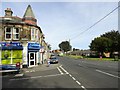
Village shop, West Pelton
This is at the crossroads in the centre of the village. This little ex mining village seems to be a reasonably thriving place, unlike some. As can be seen, it has a local bus service running to the nearby towns of Stanley and Chester-Le-Street.
Image: © Robert Graham
Taken: 16 Sep 2019
0.07 miles
4
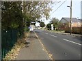
Crossroads in West Pelton
Viewed from the south, coming from Grange Villa. Both these villages are 19th century mining settlements, although the pits are all gone now.
Image: © Robert Graham
Taken: 16 Sep 2019
0.07 miles
5
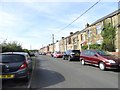
Long terraced row at West Pelton
This is Twizell Lane, which runs west from the village centre. These houses were built in the early 20th century, before the First World War, for the local miners.
Image: © Robert Graham
Taken: 16 Sep 2019
0.10 miles
6
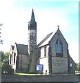
West Pelton, Co. Durham, St Paul's Church
Image: © Bill Henderson
Taken: Unknown
0.10 miles
7
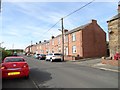
Brick terrace on Twizell Lane
At the west end of West Pelton is a long terrace of houses on Twizell Lane. It changes from stone to brick built half way along. All seem to have built in the early 20th century.
Image: © Robert Graham
Taken: 16 Sep 2019
0.11 miles
8
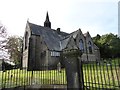
St Paul's Church, West Pelton
Built in 1880, in the Perpendicular style. The money came from the Joicy family, the local coalowners.
Image: © Robert Graham
Taken: 16 Sep 2019
0.13 miles
9
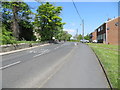
St Paul's Terrace, West Pelton
Looking north-westward towards the A693.
Image: © Peter Wood
Taken: 19 May 2018
0.13 miles
10
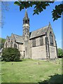
The Church of St Paul at West Pelton
Viewed from the south-east.
Image: © Peter Wood
Taken: 19 May 2018
0.14 miles