IMAGES TAKEN NEAR TO
Shotley Bridge, CONSETT, DH8 9LR
Introduction
This page details the photographs taken nearby to DH8 9LR by members of the Geograph project.
The Geograph project started in 2005 with the aim of publishing, organising and preserving representative images for every square kilometre of Great Britain, Ireland and the Isle of Man.

There are currently over 7.5m images from over14,400 individuals and you can help contribute to the project by visiting https://www.geograph.org.uk
Image Map
Images are licensed for reuse under creativecommons.org/licenses/by-sa/2.0
Notes
- Clicking on the map will re-center to the selected point.
- The higher the marker number, the further away the image location is from the centre of the postcode.
Image Listing (12 Images Found)
Images are licensed for reuse under creativecommons.org/licenses/by-sa/2.0
Image
Details
Distance
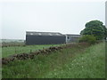
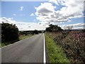
1
View across to New House Farm
Looking west from the A68. The name could refer to a farm created after enclosure of the common land, possibly the 1771 enclosure of Bolbeck Common.
Image: © Robert Graham
Taken: 16 Aug 2017
0.02 miles
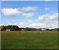
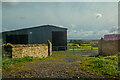
2
New House Farm
Just off the A68 Darlington to Corbridge road.
Image: © Oliver Dixon
Taken: 20 Nov 2006
0.07 miles
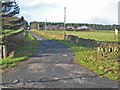
3
Road east of New House Farm
A narrow minor road runs west to east passing New House Farm; it connects a minor road with the A68 which lies ahead in the image. It's not clear if the road is a public one - there are no signs to suggest that it isn't - but the surface is poor and appears to be poorer still west of the farm.
Image: © Trevor Littlewood
Taken: 2 Oct 2015
0.15 miles
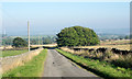
4
Long straight road to Barley Lodge
This country road runs south from Barley Hill to the A68 at Barley Lodge.
Image: © Robert Graham
Taken: 16 Aug 2017
0.17 miles
5
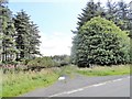
Farm track to New House Farm
From the country road south from Barley Hill. It looks rather little used, presumably the main entrance is on the other side of the farm, from the A68 (see Trevor Littlewoods pic here).
Image: © Robert Graham
Taken: 16 Aug 2017
0.18 miles
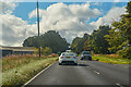
6
A68 near Bullions
Heading south west towards Darlington.
Image: © JThomas
Taken: 4 Jun 2016
0.20 miles
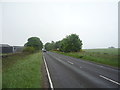
7
Shotley : A68
The A68 heading through the countryside.
Image: © Lewis Clarke
Taken: 25 Sep 2020
0.21 miles
8
Shotley : Bullions Farm
Looking towards Bullions Farm.
Image: © Lewis Clarke
Taken: 25 Sep 2020
0.21 miles
9
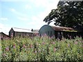
Farmstead at Bullions
This is the view from the north on the A68. The farm lies beside the road, about 2km south of Kiln Pitt Hill. The building on the left is probably an old byre and barn converted to residential use.
Image: © Robert Graham
Taken: 16 Aug 2017
0.21 miles