
IMAGES TAKEN NEAR TO
Whittonstall, CONSETT, DH8 9JF
Introduction
This page details the photographs taken nearby to DH8 9JF by members of the Geograph project.
The Geograph project started in 2005 with the aim of publishing, organising and preserving representative images for every square kilometre of Great Britain, Ireland and the Isle of Man.

There are currently over 7.5m images from over14,400 individuals and you can help contribute to the project by visiting https://www.geograph.org.uk
Image Map
Images are licensed for reuse under creativecommons.org/licenses/by-sa/2.0
Notes
- Clicking on the map will re-center to the selected point.
- The higher the marker number, the further away the image location is from the centre of the postcode.
Image Listing (7 Images Found)
Images are licensed for reuse under creativecommons.org/licenses/by-sa/2.0
Image
Details
Distance
1
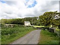
Seldom Seen
The house shown here has the delightful name of Seldom Seen. There has been a house here since the mid C19 at least, but I suspect this is a C21 replacement for the original. The name fits actually, because you can't see it from the road nearby - Boundary Lane. You have to walk along this farm road for Morrowfield Farm before the house, in the little valley of the Small Burn, comes into view.
Image: © Robert Graham
Taken: 3 Jun 2015
0.02 miles
2
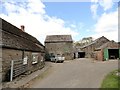
Old byer at Morrowfield Farm
This nice old farm lies west of Ebchester. It is particularly pleasing to see such a range of old outbuildings in good condition. On many old farms, these sort of structures are no longer in use and so in ruinous states. The building in the centre was probably a byer for cattle with a hay loft above. The door at first floor level was possibly to pitch the hay in from a cart backed up below
Image: © Robert Graham
Taken: 3 Jun 2015
0.05 miles
3
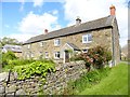
Farmhouse at Morrowfield Farm
Lovely old farmhouse; probably late C18 or early C19 date. It is shown on the 1861 First Series Ordnance Survey map. I believe this farm formed part of the nearby Newlands estate at that time.
Image: © Robert Graham
Taken: 3 Jun 2015
0.05 miles
4
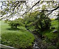
The Small Burn, near Ebchester
At this spot, the Small Burn flows under the access road from Boundary Lane to Morrowfield Farm. The stream flows into the Derwent a short distance away near Ebchester.
Image: © Robert Graham
Taken: 3 Jun 2015
0.06 miles
5
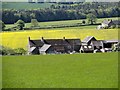
Morrowfield Farm
Viewed from the north, from the path leading down from the B6309. Also visible at the right hand side is the neighbouring farm of Fellclose.
Image: © Robert Graham
Taken: 3 Jun 2015
0.07 miles
6
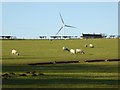
Field with sheep off Boundary Lane
Fellclose is just visible over the crest. Beyond is one of the turbines of the recently opened Boundary Lane Wind Farm.
Image: © Oliver Dixon
Taken: 8 Jan 2015
0.15 miles
7
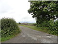
Road to Fellclose
This farm road leads north off Boundary Lane to Fellclose, seen here in the distance, and then on to Meadowfield.
Image: © Robert Graham
Taken: 26 Jul 2017
0.18 miles