
IMAGES TAKEN NEAR TO
Glenluce Court, CONSETT, DH8 8TL
Introduction
This page details the photographs taken nearby to Glenluce Court, DH8 8TL by members of the Geograph project.
The Geograph project started in 2005 with the aim of publishing, organising and preserving representative images for every square kilometre of Great Britain, Ireland and the Isle of Man.

There are currently over 7.5m images from over14,400 individuals and you can help contribute to the project by visiting https://www.geograph.org.uk
Image Map
Images are licensed for reuse under creativecommons.org/licenses/by-sa/2.0
Notes
- Clicking on the map will re-center to the selected point.
- The higher the marker number, the further away the image location is from the centre of the postcode.
Image Listing (8 Images Found)
Images are licensed for reuse under creativecommons.org/licenses/by-sa/2.0
Image
Details
Distance
2

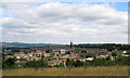
Split personality
Bridgehill to the left, Blackhill to the right. The boundary between these two suburbs of Consett runs down the middle of Pemberton Road.
Image: © Oliver Dixon
Taken: 9 Apr 2007
0.13 miles
3
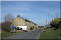
Pemberton Road entering two places!
The location is the old County Durham steel town of Consett. Pemberton road enters the urban area from the south where two separate districts of the town are being approached; the road signs - in blue and yellow - tell that Blackhill is to the right and Bridgehill to the left.
Image: © Trevor Littlewood
Taken: 19 Mar 2014
0.15 miles
4
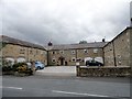
Former farm buildings at Bridgehill
These were once part of the large Bridgehill Farm. A typical C19 courtyard arrangement of outbuildings now converted to residential use.
Image: © Robert Graham
Taken: 2 Sep 2015
0.16 miles
5
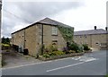
Converted farm buildings at Bridgehill
This large u-shaped courtyard of outbuildings formed part of Bridgehill Farm and is clearly shown on the 1861 First Series Ordnance Survey map. The rest of Bridgehill didn't exist then, the farm was all that was there. The buildings are now all residential.
Image: © Robert Graham
Taken: 2 Sep 2015
0.16 miles
6
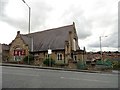
Blackhill Baptist Church
Located at the western end of Durham Road, beside the junction with Pemberton Road.
Image: © Robert Graham
Taken: 1 Sep 2017
0.24 miles
7
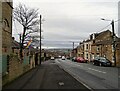
Looking down Blackhill bank
A view west looking down Durham Road. There is a fine view of the Northumberland side of the Derwent Valley in the distance.
Image: © Robert Graham
Taken: 10 Jan 2022
0.25 miles
8
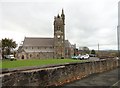
St Mary's R C Church, Blackhill
This was the first Catholic church built in Consett, in 1857. It was built to serve the large Irish Catholic community which had settled in Blackhill. The men came over to work in the steelworks and to escape the potato famine. The architect was Matthias Dunn, who designed the building in Gothic revival style. The clock tower wasn't completed until 1884.
Image: © Robert Graham
Taken: 25 Oct 2017
0.25 miles