IMAGES TAKEN NEAR TO
CONSETT, DH8 7SR
Introduction
This page details the photographs taken nearby to DH8 7SR by members of the Geograph project.
The Geograph project started in 2005 with the aim of publishing, organising and preserving representative images for every square kilometre of Great Britain, Ireland and the Isle of Man.

There are currently over 7.5m images from over14,400 individuals and you can help contribute to the project by visiting https://www.geograph.org.uk
Image Map (Loading...)


Getting Data...Please wait
Leaflet Map data © OpenStreetMap
Images are licensed for reuse under creativecommons.org/licenses/by-sa/2.0
Notes
- Clicking on the map will re-center to the selected point.
- The higher the marker number, the further away the image location is from the centre of the postcode.
Image Listing (14 Images Found)
Images are licensed for reuse under creativecommons.org/licenses/by-sa/2.0
Image
Details
Distance
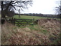
1
Entrance road to Low Brooms Farm, Leadgate
This farm is south of Brooms Lane, which runs east from the Jolly Drovers roundabout.
Image: © Robert Graham
Taken: 25 Feb 2014
0.02 miles
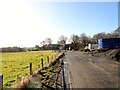
2
Low Brooms Farm
View of this old farm from Brooms Lane, looking south.
Image: © Robert Graham
Taken: 14 Sep 2020
0.02 miles
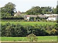
3
Low Brooms Farm
Main farm buildings at Hanging Stone on way to Disposal Site.
Image: © Colin Edgar
Taken: 8 Jan 2006
0.04 miles
4
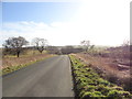
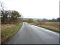
View up Brooms Lane
Country road which runs uphill from Stoney Heap to the Jolly Drovers crossroads at Leadgate.
Image: © Robert Graham
Taken: 14 Sep 2020
0.14 miles
5
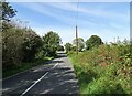
View east along Brooms Lane, Leadgate
This minor road leads towards Lanchester from the Jolly Drovers roundabout at the east end of the village.
Image: © Robert Graham
Taken: 25 Feb 2014
0.18 miles
6
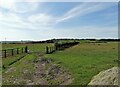
View south from Brooms Lane
Looking over the farmland beside the road. There is a fine view of the village of Iveston on its hilltop site in the distance.
Image: © Robert Graham
Taken: 14 Sep 2020
0.18 miles
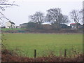
7
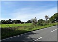
Near the top of Brooms Lane
This country road leads uphill from Stoney Heap to the crossroads at The Jolly Drovers pub at Leadgate, through some pleasant farming countryside. The buildings across the field belong to High Brooms Farm.
Image: © Robert Graham
Taken: 14 Sep 2020
0.19 miles
9
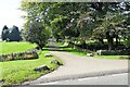
Farm entrance road
Driveway to High Brooms Farm, off Brooms Lane.
Image: © Robert Graham
Taken: 14 Sep 2020
0.21 miles