
IMAGES TAKEN NEAR TO
Summerhill, CONSETT, DH8 6SF
Introduction
This page details the photographs taken nearby to Summerhill, DH8 6SF by members of the Geograph project.
The Geograph project started in 2005 with the aim of publishing, organising and preserving representative images for every square kilometre of Great Britain, Ireland and the Isle of Man.

There are currently over 7.5m images from over14,400 individuals and you can help contribute to the project by visiting https://www.geograph.org.uk
Image Map
Images are licensed for reuse under creativecommons.org/licenses/by-sa/2.0
Notes
- Clicking on the map will re-center to the selected point.
- The higher the marker number, the further away the image location is from the centre of the postcode.
Image Listing (44 Images Found)
Images are licensed for reuse under creativecommons.org/licenses/by-sa/2.0
Image
Details
Distance
1
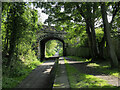
Bridge carrying B6310 over Derwent Walk
The Derwent Walk passes beneath the bridge, heading south on the old railway bed. The rectangular stones running away from the camera position are at the edge of what was the platform at Shotley Bridge Station.
Image: © Trevor Littlewood
Taken: 5 Sep 2021
0.02 miles
2
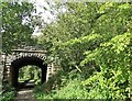
Bridge over the former railway at Shotley Station
The Derwent Valley Railway was opened in 1867. Shotley Station was just beyond the bridge. The platform edge can still be seen here. The bridge carries the B6310 to Medomsley. The railway closed in 1963, and was converted to the Derwent Walk in 1972.
Image: © Robert Graham
Taken: 4 Sep 2020
0.02 miles
3
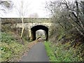
Bridge at Shotley Station
This is the old station at Shotley Bridge, on the former Derwent Valley Line, now the Derwent Walk footpath. The bridge carries the B6301 road to Medomsley.
Image: © Robert Graham
Taken: 5 Dec 2017
0.02 miles
4
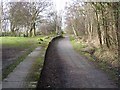
The former Shotley Bridge Station
Constructed in 1867 and running from Swalwell on the River Tyne up to Consett, the Derwent Valley railway finally closed in 1963. The footway on the line of the old railway has been converted into a cycleway and forms part of National Cycle Network route 14. This old station which closed in 1953 has been converted into a car park and picnic area.
Image: © Oliver Dixon
Taken: 28 Feb 2014
0.03 miles
5
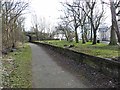
The former Shotley Bridge Station
Constructed in 1867 and running from Swalwell on the River Tyne up to Consett, the Derwent Valley railway finally closed in 1963. The footway on the line of the old railway has been converted into a cycleway and forms part of National Cycle Network route 14. This old station which closed in 1953 has been converted into a car park and picnic area. The bridge carries the B6310 from Shotley Bridge to Medomsley.
Image: © Oliver Dixon
Taken: 28 Feb 2014
0.03 miles
6
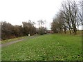
Looking south to Shotley Station
Now part of the Derwent Walk. The original platform can still be seen on the left, in front of the bridge.
Image: © Robert Graham
Taken: 5 Dec 2017
0.03 miles
7
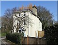
Stationmasters House at Shotley Bridge
The station was opened in 1867 as part of the Derwent Valley Railway. The station closed to passengers in 1953, and the line closed in 1963. The station was demolished shortly afterwards but the Stationmasters House survived as a private residence. The old line now forms the Derwent Walk footpath.
Image: © Robert Graham
Taken: 30 Mar 2021
0.04 miles
9
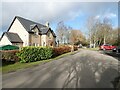
Shotley Bridge Station (as was)
Shotley Bridge Station on the Derwent Valley line opened in 1867, closed in 1953. It now forms one of the staging points on the popular Derwent Walk (National Cycle Network route 14) with a car park occupying the station site. The much-renovated Station Cottages stand on the left.
Image: © Oliver Dixon
Taken: 9 Feb 2022
0.05 miles
10
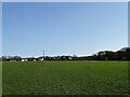
Looking across to Summerhill
View of this area of Shotley Bridge beside the station from the field path to West Law Road.
Image: © Robert Graham
Taken: 30 Mar 2021
0.07 miles