
IMAGES TAKEN NEAR TO
Station Yard, CONSETT, DH8 5YB
Introduction
This page details the photographs taken nearby to Station Yard, DH8 5YB by members of the Geograph project.
The Geograph project started in 2005 with the aim of publishing, organising and preserving representative images for every square kilometre of Great Britain, Ireland and the Isle of Man.

There are currently over 7.5m images from over14,400 individuals and you can help contribute to the project by visiting https://www.geograph.org.uk
Image Map
Images are licensed for reuse under creativecommons.org/licenses/by-sa/2.0
Notes
- Clicking on the map will re-center to the selected point.
- The higher the marker number, the further away the image location is from the centre of the postcode.
Image Listing (31 Images Found)
Images are licensed for reuse under creativecommons.org/licenses/by-sa/2.0
Image
Details
Distance
1
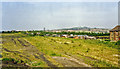
Site of Consett station, 1988
View NE, towards Annfield Plain, Birtley and Newcastle, also Pelaw and Tyne Dock: ex-NER line - passenger from Newcastle, goods from Tyne Dock. The latter included the celebrated heavy iron-ore workings to Consett Steelworks, which were on the Blackhill line, behind and to the west of this view. Consett station was closed to passengers from 23/5/55, but until 1980 this view would be full of railway sidings and the station buildings survived until then at least.
Image: © Ben Brooksbank
Taken: 23 Jun 1988
0.03 miles
2
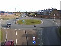
Roundabout on the Consett By-pass
Seen from a footbridge over the Consett By-pass (the A692 from Castleside to Chester-le-Street). To the left, Station Road runs into Consett town centre; to the right is Delves Lane.
Image: © Oliver Dixon
Taken: 28 Feb 2014
0.05 miles
3
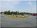
Delves Lane Roundabout
Delves Lane originally bridged the Birtley, Annfield Plain and Consett railway here. The A692 Consett By-pass follows the course of the railway and Consett Station lay between the roundabout and the green footbridge in the background
Image: © Adrian Taylor
Taken: 10 Aug 2020
0.05 miles
4
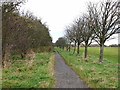
C2C at Consett
The Consett and Sunderland path (part of the famous C2C cycle route, National Cycle Network route 7) for the most part follows the line of the old railway. But here it diverges from the trackbed for about 1 km and runs along this line of trees at the edge of the Crook Hall playing fields. This was the first length of the path to be laid (in 1987).
Image: © Oliver Dixon
Taken: 13 Nov 2012
0.14 miles
5
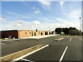
Consett Football Club
This is the new site of the football club, opened in 2013, after the old ground at Belle View Park was vacated to make way for the new Consett Academy.
Image: © Robert Graham
Taken: 25 Feb 2014
0.15 miles
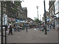
7
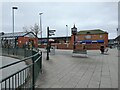
Clock at Consett Bus Station
There has been a clock here most of the time since the first bus station was built in 1936. This clock was installed in 2018. The bus station entrance is on the left.
Image: © Robert Graham
Taken: 1 Apr 2021
0.17 miles
8
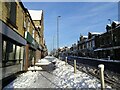
Looking up Front Street in the snow
Main street in Consett town centre.
Image: © Robert Graham
Taken: 9 Jan 2021
0.18 miles
9
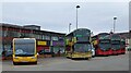
Buses at Consett Bus Station
Virtually all the services from here are operated by Go North East. There was a major modernisation of the local fleet in 2019, with new double deck buses, one of which is shown in the centre here.
Image: © Robert Graham
Taken: 1 Apr 2021
0.18 miles
10
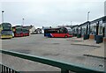
Consett Bus Station
Shown on the right here, this is the third bus station to be built on this site. The buses here are all Go North East vehicles, they operate nearly all the services in the area.
Image: © Robert Graham
Taken: 1 Apr 2021
0.18 miles