
IMAGES TAKEN NEAR TO
Shotley Park, CONSETT, DH8 0TJ
Introduction
This page details the photographs taken nearby to Shotley Park, DH8 0TJ by members of the Geograph project.
The Geograph project started in 2005 with the aim of publishing, organising and preserving representative images for every square kilometre of Great Britain, Ireland and the Isle of Man.

There are currently over 7.5m images from over14,400 individuals and you can help contribute to the project by visiting https://www.geograph.org.uk
Image Map
Images are licensed for reuse under creativecommons.org/licenses/by-sa/2.0
Notes
- Clicking on the map will re-center to the selected point.
- The higher the marker number, the further away the image location is from the centre of the postcode.
Image Listing (36 Images Found)
Images are licensed for reuse under creativecommons.org/licenses/by-sa/2.0
Image
Details
Distance
1
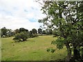
Field beside Snows Green Road
Now part of Shotley Bridge, Snows Green was once a rural hamlet and is still on the edge of the countryside. The farm buildings can be glimpsed in the trees.
Image: © Robert Graham
Taken: 1 Sep 2017
0.14 miles
2
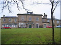
Shotley Park Home
Shotley Park home now used as a carehome for the elderly and located in the main grounds of Shotley Park.
Image: © Colin Edgar
Taken: 8 Jan 2006
0.16 miles
4
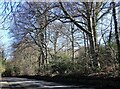
Trees beside the A694 at Shotley Bridge
A tree lined section of the road north of the village. This road was opened in 1831 as a turnpike running from Shotley to Gateshead. Long known as The Low Road, as it runs along the valley bottom. The high road was the route along the top of the valley from Consett to Gateshead via Dipton and Sunniside. A much rougher route with a lot of hills, it is now the A692.
Image: © Robert Graham
Taken: 27 Mar 2023
0.17 miles
5
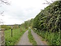
Track to Shotley Park
Old lane leading off West Law Road to the former country house at Shotley Park.
Image: © Robert Graham
Taken: 3 May 2019
0.17 miles
6
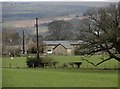
Snows Green Farm, Shotley Bridge
Viewed from the east, on West Law Lane. The slopes of the Derwent Valley can be seen in the distance.
Image: © Robert Graham
Taken: 28 Feb 2016
0.17 miles
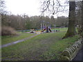
8
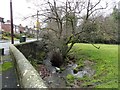
Elm Park Burn at Shotley Bridge
This little stream flows here beside Snow's Green Road.
Image: © Robert Graham
Taken: 25 Nov 2019
0.18 miles
9
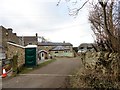
Converted buildings at Snow's Green Farm
There is a modern working farm here, but most of the old C19 buildings have been converted to residential use. That includes the gin gang - the building in the centre here with the segmented roof. This would once have housed a horse engine to drive a threshing machine in the adjacent barn.
Image: © Robert Graham
Taken: 19 Feb 2017
0.18 miles
10
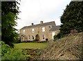
Farmhouse at Snow's Green
Probably early C19. This was a small isolated agricultural hamlet but is now part of Shotley Bridge.
Image: © Robert Graham
Taken: 19 Feb 2017
0.18 miles