
IMAGES TAKEN NEAR TO
Woodlands Road, CONSETT, DH8 0DJ
Introduction
This page details the photographs taken nearby to Woodlands Road, DH8 0DJ by members of the Geograph project.
The Geograph project started in 2005 with the aim of publishing, organising and preserving representative images for every square kilometre of Great Britain, Ireland and the Isle of Man.

There are currently over 7.5m images from over14,400 individuals and you can help contribute to the project by visiting https://www.geograph.org.uk
Image Map
Images are licensed for reuse under creativecommons.org/licenses/by-sa/2.0
Notes
- Clicking on the map will re-center to the selected point.
- The higher the marker number, the further away the image location is from the centre of the postcode.
Image Listing (13 Images Found)
Images are licensed for reuse under creativecommons.org/licenses/by-sa/2.0
Image
Details
Distance
2
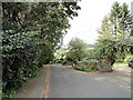
Top of Church Bank, Benfieldside
This lane runs off the west side of Benfieldside Road and down a steep bank to St Cuthbert's Church, the parish church of Shotley Bridge.
Image: © Robert Graham
Taken: 1 Sep 2017
0.19 miles
3
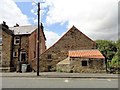
Old building on Benfieldside Road
Benfieldside is one of the oldest areas of Consett. The stone building here may have been an old farm at one time.
Image: © Robert Graham
Taken: 1 Sep 2017
0.22 miles
5
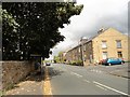
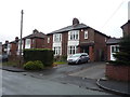
View along Benfieldside Road
Looking north along the road. This area of Consett was developed early, being next to Shotley Bridge. The houses on the right are probably early Victorian.
Image: © Robert Graham
Taken: 1 Sep 2017
0.24 miles
6
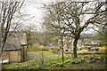
Sloping ground above St. Cuthbert's Church
St. Cuthbert's Church in Shotley Bridge is on the steep, narrow Church Lane.The ground around the church is walled and mainly limited to what is in view in the image and equally steep land to the left. It would normally be thought of as a graveyard and graves are there, but very few. The building beyond the largest tree is the church hall.
Image: © Trevor Littlewood
Taken: 7 Apr 2021
0.24 miles
7
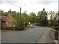
East end of Snows Green Road at Shotley Bridge
The main road goes around a sharp bend on the right up Benfieldside Road. The road on the left leads up the hill to Medomsley. Snows Green was a separate little hamlet prior to the C20.
Image: © Robert Graham
Taken: 3 May 2019
0.24 miles
8
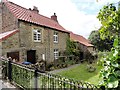
Old cottages on Benfieldside Road
Benfieldside is one of the oldest suburbs of Consett, and these cottages look to be a good age. Perhaps early C19. Nice garden.
Image: © Robert Graham
Taken: 1 Sep 2017
0.24 miles
9
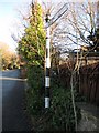
Direction Sign - Signpost by the B6310, Snows Green Road, Shotley Bridge
Pyramid finial - 1 arm; by the B6310, in parish of Consett (Derwentside District), Snows Green Road, Shotley Bridge, junction with Benfieldside Road.
Surveyed
Milestone Society National ID: DU_NZ0953
Image: © Milestone Society
Taken: Unknown
0.24 miles
10
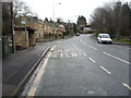
Bus stop and shelter on Snow's Green Road, Shotley Bridge
Image: © JThomas
Taken: 2 Apr 2016
0.24 miles