IMAGES TAKEN NEAR TO
Cornsay Colliery, DURHAM, DH7 9DB
Introduction
This page details the photographs taken nearby to DH7 9DB by members of the Geograph project.
The Geograph project started in 2005 with the aim of publishing, organising and preserving representative images for every square kilometre of Great Britain, Ireland and the Isle of Man.

There are currently over 7.5m images from over14,400 individuals and you can help contribute to the project by visiting https://www.geograph.org.uk
Image Map
Images are licensed for reuse under creativecommons.org/licenses/by-sa/2.0
Notes
- Clicking on the map will re-center to the selected point.
- The higher the marker number, the further away the image location is from the centre of the postcode.
Image Listing (22 Images Found)
Images are licensed for reuse under creativecommons.org/licenses/by-sa/2.0
Image
Details
Distance
1
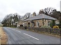
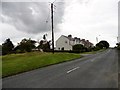
"The Lodge", Cornsay Colliery village
It is not clear where this was the lodge for.
Image: © Oliver Dixon
Taken: 15 Mar 2013
0.01 miles
3
Road entering Cornsay Colliery
Looking westward.
Image: © Peter Wood
Taken: 31 Mar 2017
0.06 miles
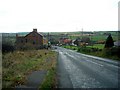
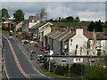
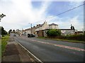
4
Cornsay Colliery, main street
Just about the only street too, in this former mining village. It runs down the bank from here.
Image: © Robert Graham
Taken: 15 Aug 2012
0.08 miles
5
Cornsay Colliery
Cornsay Colliery is an old 'pit village' of County Durham.
Image: © Trevor Littlewood
Taken: 4 May 2010
0.13 miles
6
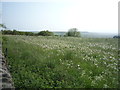
Field full of dandelions, Clickemin Hill
Off Hedleyhill Lane.
Image: © JThomas
Taken: 4 Jun 2016
0.15 miles
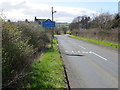
7
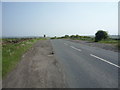
Hedleyhill Lane (B6301)
Looking south on Dere Street Roman Road.
Image: © JThomas
Taken: 4 Jun 2016
0.16 miles
8
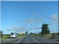
The B6301 nearing crossroads on Clickemin Hill
Image: © Peter Robinson
Taken: 18 Sep 2013
0.19 miles
9
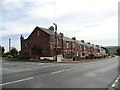
Wilk's Hill
This little hamlet consists of just 2 short terraced streets and a farm. The farm is on the first series Ordnance Survey map of 1861, but the houses don't appear until the 1898 one. They are possibly connected to the coal mining which once went on in this area.
Image: © Robert Graham
Taken: 7 Jul 2015
0.20 miles
10
Looking up the bank at Cornsay Colliery
This former mining village to the west of Durham is built along a steep road. Probably there were houses both sides in the past.
Image: © Robert Graham
Taken: 15 Aug 2012
0.20 miles