IMAGES TAKEN NEAR TO
Quarry Crescent, DURHAM, DH7 7DR
Introduction
This page details the photographs taken nearby to Quarry Crescent, DH7 7DR by members of the Geograph project.
The Geograph project started in 2005 with the aim of publishing, organising and preserving representative images for every square kilometre of Great Britain, Ireland and the Isle of Man.

There are currently over 7.5m images from over14,400 individuals and you can help contribute to the project by visiting https://www.geograph.org.uk
Image Map
Images are licensed for reuse under creativecommons.org/licenses/by-sa/2.0
Notes
- Clicking on the map will re-center to the selected point.
- The higher the marker number, the further away the image location is from the centre of the postcode.
Image Listing (14 Images Found)
Images are licensed for reuse under creativecommons.org/licenses/by-sa/2.0
Image
Details
Distance
3
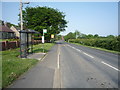
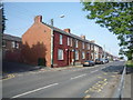
Bus stop and shelter on Woodland Road, Bearpark
Image: © JThomas
Taken: 4 Jun 2016
0.06 miles
4
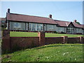
Whitehouse Farm, Bearpark
Old farm located at the west end of the former mining village of Bearpark.
Image: © Robert Graham
Taken: 10 Jul 2013
0.08 miles
5
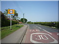
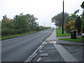
Entering Bearpark
Heading east on Woodland Road.
Image: © JThomas
Taken: 4 Jun 2016
0.10 miles
7
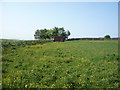
Grazing near Red House Farm
Off Woodland Road.
Image: © JThomas
Taken: 4 Jun 2016
0.16 miles
8
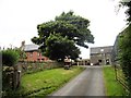
Looking down Whitehouse Lane, Bearpark
This lane at the west end of the village leads down to Ushaw Moor. As Bearpark is on the top of the ridge above the Deerness valley, there are good views from here.
Image: © Robert Graham
Taken: 10 Jul 2013
0.17 miles
9
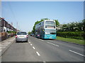
Auton Stile, Bearpark
Arriva bus on the 48 route from Durham to Brancepeth.
Image: © JThomas
Taken: 4 Jun 2016
0.18 miles
10
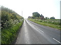
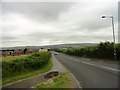
Woodland Road
Looking west near Red House Farm.
Image: © JThomas
Taken: 4 Jun 2016
0.19 miles