
IMAGES TAKEN NEAR TO
Millfield, DURHAM, DH7 0JD
Introduction
This page details the photographs taken nearby to Millfield, DH7 0JD by members of the Geograph project.
The Geograph project started in 2005 with the aim of publishing, organising and preserving representative images for every square kilometre of Great Britain, Ireland and the Isle of Man.

There are currently over 7.5m images from over14,400 individuals and you can help contribute to the project by visiting https://www.geograph.org.uk
Image Map
Images are licensed for reuse under creativecommons.org/licenses/by-sa/2.0
Notes
- Clicking on the map will re-center to the selected point.
- The higher the marker number, the further away the image location is from the centre of the postcode.
Image Listing (46 Images Found)
Images are licensed for reuse under creativecommons.org/licenses/by-sa/2.0
Image
Details
Distance
1
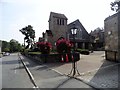
All Saints R C Church, Lanchester
On Kitswell Road on the western side of the village. Built in 1926.
Image: © Robert Graham
Taken: 12 Sep 2014
0.05 miles
2
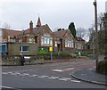
All Saints R. C. Primary School
On Kitswell Road Lanchester.
Image: © Russel Wills
Taken: 12 Jan 2013
0.06 miles
3
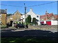
West end of Front Street in Lanchester
The road makes a sharp turn to the east here to join the A691 by-pass around the village. The red brick building on the right is the R C Primary School.
Image: © Robert Graham
Taken: 3 Aug 2021
0.06 miles
4

Looking upstream from the Front Street bridge
View along the Smallhope Burn, which flows through Lanchester village. The bridge here is just off the A691.
Image: © Robert Graham
Taken: 10 Jan 2017
0.09 miles
5
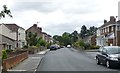
Kitswell Road, Lanchester
A residential street in this quiet village.
Image: © Russel Wills
Taken: 4 Sep 2018
0.09 miles
6

The Smallhope Burn, Lanchester
This stream flows into the village from the west. Houses opposite are Fenhall Park.
Image: © Robert Graham
Taken: 10 Jan 2017
0.09 miles
7
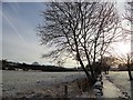
Looking along the footpath beside the A691
This is the main road through Lanchester from the north. It now forms a bypass around the village centre. View looking south from just beyond the junction with Howden Bank.
Image: © Robert Graham
Taken: 12 Dec 2017
0.10 miles
8
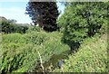
The Smallhope Burn
The section on the west side of the village. This stream runs through the centre of the village, although partly in a culvert.
Image: © Robert Graham
Taken: 3 Aug 2021
0.12 miles
9
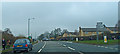
A691, Lanchester
St. Bede's Schools out. Waiting to turn on to the A6076 to Annfield Plain.
Image: © wfmillar
Taken: 31 Mar 2014
0.12 miles
10
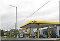
Filling station, Lanchester
Near the junction of the A691 and A6076.
Image: © Pauline E
Taken: 10 Oct 2009
0.12 miles