IMAGES TAKEN NEAR TO
Thinford, DURHAM, DH6 5JX
Introduction
This page details the photographs taken nearby to DH6 5JX by members of the Geograph project.
The Geograph project started in 2005 with the aim of publishing, organising and preserving representative images for every square kilometre of Great Britain, Ireland and the Isle of Man.

There are currently over 7.5m images from over14,400 individuals and you can help contribute to the project by visiting https://www.geograph.org.uk
Image Map
Images are licensed for reuse under creativecommons.org/licenses/by-sa/2.0
Notes
- Clicking on the map will re-center to the selected point.
- The higher the marker number, the further away the image location is from the centre of the postcode.
Image Listing (14 Images Found)
Images are licensed for reuse under creativecommons.org/licenses/by-sa/2.0
Image
Details
Distance
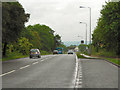
1
A167 Approaching Thinford
Looking south on the A167 as it approaches the Thinford roundabout.
Image: © David Dixon
Taken: 22 Jun 2011
0.04 miles
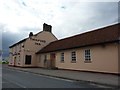
3
Durhamgate
Durhamgate is the largest mixed-use regeneration scheme in the North East of England, incorporating commercial, living and leisure opportunities
Image: © JThomas
Taken: 28 Nov 2015
0.13 miles
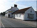
4
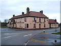
The Thinford Inn
Currently closed and boarded up.
Image: © JThomas
Taken: 28 Nov 2015
0.14 miles
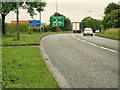
6
A167 Towards Durham
Looking north on the A167 from a lay by north of Thinford.
Image: © David Dixon
Taken: 22 Jun 2011
0.16 miles
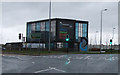
8
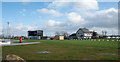
Open space at 'DurhamGate'
DurhamGate (sic) is a development of residential and commercial property close to Spennymoor. The two buildings in view are, to the left, the development's own office building and to the right, a pub, 'The Fox Cub'.
According to a map on the project's web site the area in view and surrounding will be developed for retail use.... shops!
Image: © Trevor Littlewood
Taken: 7 Feb 2016
0.18 miles
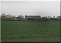
9
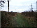
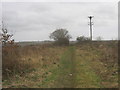
Farm track (bridleway), Thinfrod
Heads north from the A688.
Image: © JThomas
Taken: 28 Nov 2015
0.19 miles