IMAGES TAKEN NEAR TO
Haswell, DURHAM, DH6 2AN
Introduction
This page details the photographs taken nearby to DH6 2AN by members of the Geograph project.
The Geograph project started in 2005 with the aim of publishing, organising and preserving representative images for every square kilometre of Great Britain, Ireland and the Isle of Man.

There are currently over 7.5m images from over14,400 individuals and you can help contribute to the project by visiting https://www.geograph.org.uk
Image Map
Images are licensed for reuse under creativecommons.org/licenses/by-sa/2.0
Notes
- Clicking on the map will re-center to the selected point.
- The higher the marker number, the further away the image location is from the centre of the postcode.
Image Listing (10 Images Found)
Images are licensed for reuse under creativecommons.org/licenses/by-sa/2.0
Image
Details
Distance
1
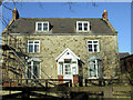
Pesspool Hall, Hall Lane, Haswell
Pesspool Hall, Haswell photographed on the 28th November 2008.
The building was later demolished.
Image: © Philip Soakell
Taken: 28 Nov 2008
0.01 miles
3

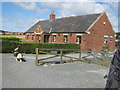
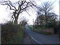
South Hetton Railway
A dip in the trackbed. Embankments were often built with lower quality coal and in the Winter of 1984-85 striking miners dug into disused railways to find coal for heating. There are numerous bits of missing embankment on the South Hetton railway.
Image: © Richard Webb
Taken: 9 Aug 2016
0.11 miles
4
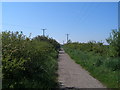
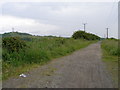
Haswell to Hart Walkway
A promoted trail along the disused railway
Image: © John Slater
Taken: 27 May 2012
0.14 miles
7
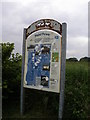
Target practice
Signpost for the Haswell to Hart Countryside walk.
Image: © Carol Rose
Taken: 23 Jun 2007
0.23 miles
8
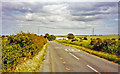
Approaching site of level crossing on the Pesspool Branch railway line, 2002
View eastward, towards Easington: the Pesspool Branch railway was a mineral railway line and ran from South Hetton, past the railway sidings at Tuthill Quarry to Pesspool Junction where it joined the main Sunderland to Hartlepool railway line (by-passing Haswell village completely). The unmanned level crossing was about 150 metres ahead.
The former line is now part of the Sustrans National Cycle route #1.
Image: © Ben Brooksbank
Taken: 23 Jun 2002
0.24 miles
9
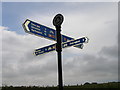
Cycleway junction
Routes 1 and 14 meet and continue down the Haswell to Hart Countryside Walk.
Image: © Carol Rose
Taken: 23 Jun 2007
0.25 miles