
IMAGES TAKEN NEAR TO
Lady Durham Close, DURHAM, DH6 1RW
Introduction
This page details the photographs taken nearby to Lady Durham Close, DH6 1RW by members of the Geograph project.
The Geograph project started in 2005 with the aim of publishing, organising and preserving representative images for every square kilometre of Great Britain, Ireland and the Isle of Man.

There are currently over 7.5m images from over14,400 individuals and you can help contribute to the project by visiting https://www.geograph.org.uk
Image Map
Images are licensed for reuse under creativecommons.org/licenses/by-sa/2.0
Notes
- Clicking on the map will re-center to the selected point.
- The higher the marker number, the further away the image location is from the centre of the postcode.
Image Listing (23 Images Found)
Images are licensed for reuse under creativecommons.org/licenses/by-sa/2.0
Image
Details
Distance
1
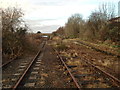
Former goods dock at Sherburn Colliery station
This is the Leamside Line, which previously linked the East Coast Mainline south of Durham with Heworth in Gateshead, passing through Washington.
Passenger services were withdrawn on this section of the line in 1941. It remained for freight use only (as a 'Mineral Railway' for coal). It had served as the East Coast line until 1872, when it was diverted to the west of Durham city.
This section, south of what once was Sherburn Colliery station (the main body of the station lay to the north of the bridge in the distance) is due to have the tracks lifted imminently. Trees and vegetation have been removed from the line in anticipation of this work. The trackbed is not to be sold and all plans to reinstate the line have been deferred until at least 2019. The line was first opened in 1839.
The platform to the right is the only evidence of Sherburn Colliery station that remains. It was used as a goods dock. Further information on the station, including photographs before and after closure, and of the area following the track removal in 2013, can be found at http://www.disused-stations.org.uk/s/sherburn_colliery/index.shtml
Image: © Dean Molyneaux
Taken: 25 Nov 2012
0.07 miles
2
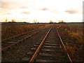
Disused Leamside line at Sherburn, looking south
This is the Leamside Line, which previously linked the East Coast Mainline south of Durham with Heworth in Gateshead, passing through Washington.
With passenger services withdrawn in 1954, it was consigned to freight use only (as a 'Mineral Railway' for coal). It had served as the East Coast line until 1872, when it was diverted to the west of Durham city.
This section, south of Sherburn towards the mainline, is due to have the tracks lifted imminently. Trees and vegetation have been removed from the line in anticipation of this work. The trackbed is not to be sold and all plans to reinstate the line have been deferred until at least 2019. The line was first opened in 1839.
Image: © Dean Molyneaux
Taken: 25 Nov 2012
0.14 miles
3
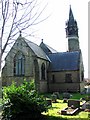
Church of St Mary The Virgin, Sherburn
Image: © Bill Henderson
Taken: 9 Mar 2007
0.14 miles
4
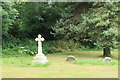
Sherburn Parish Church Churchyard
The Churchyard located to the rear of the church.
Image: © edward mcmaihin
Taken: 20 Jul 2013
0.14 miles
5
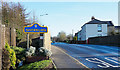
B1283 entering Sherburn
The road entering the village from the west immediately to cross a bridge over a dismantled railway. It also passes a road sign in a style typical of others in County Durham.
Image: © Trevor Littlewood
Taken: 20 Jan 2020
0.15 miles
7
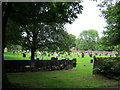
Churchyard at St Mary's Church Sherburn
Image: © Peter Robinson
Taken: 12 Jul 2011
0.17 miles
8
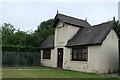
Sherburn Village Bowling Green Clubhouse
The Sherburn village bowling green clubhouse.
Image: © edward mcmaihin
Taken: 20 Jul 2013
0.17 miles
9
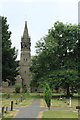
Sherburn Parish Church
The Parish Church viewed from inside the cemetery.
Image: © edward mcmaihin
Taken: 20 Jul 2013
0.17 miles
10
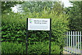
Sherburn Village Bowling Green Sign
Bowling green sign.
Image: © edward mcmaihin
Taken: 20 Jul 2013
0.17 miles