IMAGES TAKEN NEAR TO
Rosedale Street, HOUGHTON LE SPRING, DH5 0EA
Introduction
This page details the photographs taken nearby to Rosedale Street, DH5 0EA by members of the Geograph project.
The Geograph project started in 2005 with the aim of publishing, organising and preserving representative images for every square kilometre of Great Britain, Ireland and the Isle of Man.

There are currently over 7.5m images from over14,400 individuals and you can help contribute to the project by visiting https://www.geograph.org.uk
Image Map
Images are licensed for reuse under creativecommons.org/licenses/by-sa/2.0
Notes
- Clicking on the map will re-center to the selected point.
- The higher the marker number, the further away the image location is from the centre of the postcode.
Image Listing (10 Images Found)
Images are licensed for reuse under creativecommons.org/licenses/by-sa/2.0
Image
Details
Distance
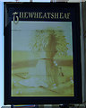
2
The Wheatsheaf, Low Moorsley
On Moorsley Road.
Image: © JThomas
Taken: 28 May 2015
0.04 miles
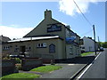
3
The Wheatsheaf Low Moorsley
Pub at the West end of the village.
Image: © Robert Graham
Taken: 11 Apr 2012
0.05 miles

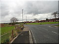
5
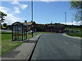
Bus stop and shelter on Moorsley Road, Low Moorsley
Image: © JThomas
Taken: 28 May 2015
0.09 miles
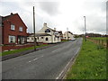
6
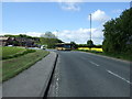
Moorsley Road. Low Moorsley
Heading south west.
Image: © JThomas
Taken: 28 May 2015
0.13 miles
7
Coal Bank Farm at Low Moorsley
Interesting collection of farm vehicles and machinery here.
Image: © Robert Graham
Taken: 11 Apr 2012
0.14 miles
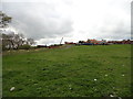
8
View East at Low Moorsley
Looking from the road on the North side of the village.
Image: © Robert Graham
Taken: 11 Apr 2012
0.17 miles
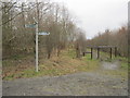
10
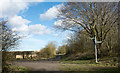
Meeting of bridleways near Low Moorsley
The bridleway ahead is part of the national cycleway, the W2W, Walney to Wear route. To the left there's another bridleway, a rough road, going to East Rainton. The route to the right is a public footpath to Low Moorsley.
Image: © Trevor Littlewood
Taken: 2 Mar 2017
0.23 miles