IMAGES TAKEN NEAR TO
High Row, HOUGHTON LE SPRING, DH4 6BD
Introduction
This page details the photographs taken nearby to High Row, DH4 6BD by members of the Geograph project.
The Geograph project started in 2005 with the aim of publishing, organising and preserving representative images for every square kilometre of Great Britain, Ireland and the Isle of Man.

There are currently over 7.5m images from over14,400 individuals and you can help contribute to the project by visiting https://www.geograph.org.uk
Image Map
Images are licensed for reuse under creativecommons.org/licenses/by-sa/2.0
Notes
- Clicking on the map will re-center to the selected point.
- The higher the marker number, the further away the image location is from the centre of the postcode.
Image Listing (20 Images Found)
Images are licensed for reuse under creativecommons.org/licenses/by-sa/2.0
Image
Details
Distance
2
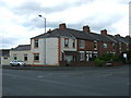
Terraced housing on Finchdale Terrace, Woodstone Village
Image: © JThomas
Taken: 28 May 2015
0.06 miles
3
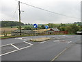
Traffic Calming near Woodstone Village
Image: © Alex McGregor
Taken: 28 Sep 2010
0.06 miles
4
Lane near Fencehouses
A lane providing access to the rear of houses, near Fencehouses in County Durham.
Image: © Malc McDonald
Taken: 29 Aug 2011
0.08 miles
6
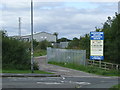
Woodstone Village Industrial Estate, near Fencehouses
The entrance to a small estate of industrial units near Fencehouses in County Durham.
Image: © Malc McDonald
Taken: 29 Aug 2011
0.09 miles
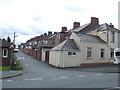
7
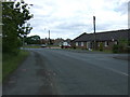
Lumley New Road (B1284), Woodstone Village
Looking east.
Image: © JThomas
Taken: 28 May 2015
0.09 miles
8
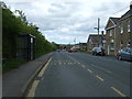
Bus stop and shelter on Lumley New Road
Looking east.
Image: © JThomas
Taken: 28 May 2015
0.10 miles
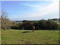
9
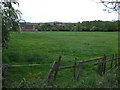
Grazing off Lumley New Road, Woodstone Village
Image: © JThomas
Taken: 28 May 2015
0.12 miles
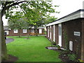
10
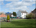
Grassed area at Fencehouses
Fencehouses is a small village close to the County Durham and Sunderland boundary, the majority of it lying within the Sunderland unitary authority. It's odd then, perhaps, that the blue and yellow road sign is in the County Durham style, though of course, the sign does stand within the county.
Image: © Trevor Littlewood
Taken: 23 Mar 2018
0.16 miles