
IMAGES TAKEN NEAR TO
Lyndhurst Avenue, CHESTER LE STREET, DH3 4AT
Introduction
This page details the photographs taken nearby to Lyndhurst Avenue, DH3 4AT by members of the Geograph project.
The Geograph project started in 2005 with the aim of publishing, organising and preserving representative images for every square kilometre of Great Britain, Ireland and the Isle of Man.

There are currently over 7.5m images from over14,400 individuals and you can help contribute to the project by visiting https://www.geograph.org.uk
Image Map
Images are licensed for reuse under creativecommons.org/licenses/by-sa/2.0
Notes
- Clicking on the map will re-center to the selected point.
- The higher the marker number, the further away the image location is from the centre of the postcode.
Image Listing (23 Images Found)
Images are licensed for reuse under creativecommons.org/licenses/by-sa/2.0
Image
Details
Distance
2
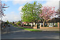
Chester-le-Street: Lyndhurst Avenue
South of Low Flatts Road, off North Road on the northern fringe of Chester-le-Street.
Image: © John Sutton
Taken: 24 Apr 2022
0.06 miles
3
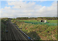
The East Coast Main Line south of Low Flatts Road Bridge
Looking south towards Chester-le-Street on a bright Sunday morning in late April.
Image: © John Sutton
Taken: 24 Apr 2022
0.06 miles
4
Newcastle Road/A693 roundabout from Newcastle Road
Image: © P Glenwright
Taken: 18 Sep 2006
0.07 miles
5
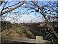
Main line at South Pelaw
Looking north up the railway from the A693 bridge over the line.
Image: © Robert Graham
Taken: 6 Feb 2013
0.07 miles
6
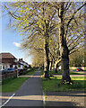
North Road on an April evening
On the northern edge of Chester-le-Street.
Image: © John Sutton
Taken: 22 Apr 2022
0.08 miles
7
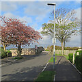
Chester-le-Street: on Low Flatts Road
The end of a residential street on the northern fringe of Chester-le-Street. The road ends here and becomes a footpath beyond the bridge over the East Coast Main Line.
Image: © John Sutton
Taken: 24 Apr 2022
0.09 miles
8
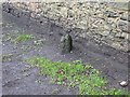
Old Milestone by the A167, North Road, Chester le Street
Carved stone post by the A167, in parish of CHESTER LE STREET (CHESTER LE STREET District), North Road, back of footpath and grass beside stone wall, on East side of road. G/D stone, erected by the Durham & Tyne Bridge turnpike trust in the 19th century.
Inscription once read:- : (G / 3) : : (D / 9) :
(To Gateshead and Durham)
Milestone Society National ID: DU_GHDH03.
Image: © Mike Rayner
Taken: 4 Mar 2016
0.09 miles
9
Chester-le-Street: Wear Lodge
North of Low Flatts Road, off North Road on the northern fringe of Chester-le-Street.
Image: © John Sutton
Taken: 24 Apr 2022
0.11 miles
10
Chester-le-Street: The Lambton Worm
A popular place to drink, eat and stay, on the northern edge of the town.
Image: © John Sutton
Taken: 22 Apr 2022
0.12 miles